|
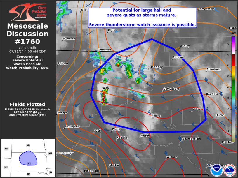
| Mesoscale Discussion 1760 |
|
< Previous MD Next MD >
|

|
   Mesoscale Discussion 1760
   NWS Storm Prediction Center Norman OK
   0207 AM CDT Wed Jul 31 2024

   Areas affected...Northwest to central SD and far south-central ND

   Concerning...Severe potential...Watch possible

   Valid 310707Z - 310900Z

   Probability of Watch Issuance...60 percent

   SUMMARY...A threat for large hail and severe gusts, including
   potential for significant severe, may occur as scattered storms
   mature over northwest into north-central South Dakota. Some
   uncertainty exists on timing of a sustained severe threat, so a
   watch issuance is possible.

   DISCUSSION...UDX VWP data confirm the presence of near 25-kt
   southerly lower-level jet which is aiding in convection developing
   across a portion of northwest into north-central SD. This appears to
   be occurring to the north/west of a weak surface cyclone in vicinity
   of Ziebach/Dewey counties. Upstream, a shortwave trough evident in
   water vapor imagery near the Bighorn Mountains will likely enhance
   large-scale ascent later this morning. The bulk of evening CAM
   guidance suggests this will aid in a more sustained severe threat,
   but the HRW-ARW indicated a more earlier threat which is better
   timed to the ongoing development. The presence of a rather steep
   lapse rate environment and adequate deep-layer shear for supercells
   suggest that any sustained updrafts will have the potential to
   produce large hail and severe gusts, which may become significant.
   This should occur as convection impinges on increasingly larger
   buoyancy emanating north from south-central/southeast SD.

   ..Grams/Guyer.. 07/31/2024

   ...Please see www.spc.noaa.gov for graphic product...

   ATTN...WFO...FSD...ABR...BIS...UNR...

   LAT...LON   45430224 45880161 46240031 46019956 45499890 44819859
               44319851 44029900 44010056 44250191 44880236 45430224
|
|
Top/All Mesoscale Discussions/Forecast Products/Home
|
|


