|
| Mesoscale Discussion 1759 |
|
< Previous MD Next MD >
|

|
   Mesoscale Discussion 1759
   NWS Storm Prediction Center Norman OK
   1117 PM CDT Tue Jul 30 2024

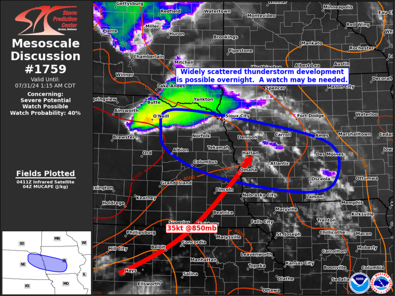
   Areas affected...Eastern Nebraska...Western Iowa

   Concerning...Severe potential...Watch possible

   Valid 310417Z - 310615Z

   Probability of Watch Issuance...40 percent

   SUMMARY...Thunderstorm initiation may occur in the 04-07z period
   across eastern Nebraska and western Iowa.  If this scenario occurs,
   parameters would suggest a risk of large hail and damaging winds.  A
   severe thunderstorm watch could be needed.

   DISCUSSION...Recent surface analysis shows very moist low-level
   conditions in place across eastern NE/western IA, with dewpoints in
   the low-mid 70s.  This, combined with very steep mid-level lapse
   rates are yielding large CAPE values of 3000-4500 J/kg.  Low-level
   convergence is weak, but a 30-40 knot southwesterly low-level jet
   will focus warm advection and lift across the region, likely aiding
   in the development of scattered thunderstorms.  00z CAM guidance
   varies on placement and timing of this development, but recent IR
   images indicate patches of CU/TCU in the region that could mature
   into thunderstorms within the next few hours.  Sufficient westerly
   flow aloft will help to organize storms into rotating/bowing
   structures.  If this scenario unfolds, a severe thunderstorm watch
   may be needed.

   ..Hart.. 07/31/2024

   ...Please see www.spc.noaa.gov for graphic product...

   ATTN...WFO...DMX...FSD...OAX...LBF...

   LAT...LON   42709800 42419530 41879309 40989306 40819422 41189667
               41729808 42219835 42709800
|
|
Top/All Mesoscale Discussions/Forecast Products/Home
|
|


