|
| Mesoscale Discussion 1761 |
|
< Previous MD Next MD >
|

|
   Mesoscale Discussion 1761
   NWS Storm Prediction Center Norman OK
   0231 AM CDT Wed Jul 31 2024

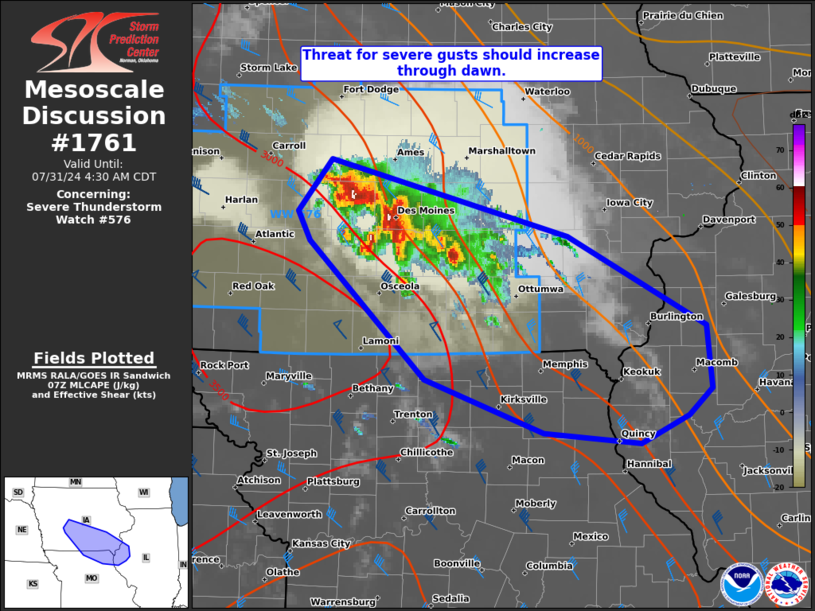
   Areas affected...south-central/southeast IA...northeast
   MO...west-central IL

   Concerning...Severe Thunderstorm Watch 576...

   Valid 310731Z - 310930Z

   The severe weather threat for Severe Thunderstorm Watch 576
   continues.

   SUMMARY...An isolated large hail and localized damaging wind threat
   in the greater Des Moines metro area may shift southeast through
   dawn, with increasing potential for severe gusts. An additional
   severe thunderstorm watch issuance may be needed to the
   east-southeast of WW 576.

   DISCUSSION...Convection has largely congealed over the greater Des
   Moines metro area within the exit region of a southwesterly
   low-level jet. This convection has only produced reported hail up to
   1.25 inches in diameter, despite deep convective cores characterized
   by echo tops to 60 kft and cold cloud-top temperatures in IR
   imagery. Given how deep this cluster has become, and with additional
   cells forming along its southern flank, a strengthening surface cold
   pool should develop over the next couple hours. Within the
   prevailing westerly mid-level flow regime per DMX VWP data, this
   should yield a southeastward movement to the cluster along the
   pronounced MLCAPE gradient. Potential acceleration would yield a
   corresponding increase in the severe gust threat, that should spread
   southeast towards a portion of the Mid-MO Valley later this morning.

   ..Grams/Guyer.. 07/31/2024

   ...Please see www.spc.noaa.gov for graphic product...

   ATTN...WFO...ILX...LSX...DVN...DMX...EAX...

   LAT...LON   41649457 42029423 41879356 41459189 40799054 40319049
               40129071 39909118 39989213 40399331 41429445 41649457
|
|
Top/All Mesoscale Discussions/Forecast Products/Home
|
|


