|
| Mesoscale Discussion 1758 |
|
< Previous MD Next MD >
|

|
   Mesoscale Discussion 1758
   NWS Storm Prediction Center Norman OK
   1056 PM CDT Tue Jul 30 2024

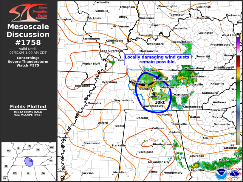
   Areas affected...Middle Tennessee

   Concerning...Severe Thunderstorm Watch 575...

   Valid 310356Z - 310600Z

   The severe weather threat for Severe Thunderstorm Watch 575
   continues.

   SUMMARY...Locally gusty/damaging winds will remain possible along a
   line of storms moving southward across middle Tennessee.

   DISCUSSION...A loosely organized line of thunderstorms is moving
   southward across northern middle Tennessee at 25-30 knots.  Local
   radar depictions recently suggested areas of 30-50 knot low-level
   winds behind the gust front as the storms tracked through the
   greater Nashville region.  This line will continue to move through a
   very moist and moderately unstable air mass for several more hours,
   posing some risk of locally gusty/damaging wind gusts.

   ..Hart.. 07/31/2024

   ...Please see www.spc.noaa.gov for graphic product...

   ATTN...WFO...OHX...HUN...

   LAT...LON   36518706 35918595 34998610 35018711 35718761 36248751
               36518706
|
|
Top/All Mesoscale Discussions/Forecast Products/Home
|
|


