|
| Mesoscale Discussion 1757 |
|
< Previous MD Next MD >
|

|
   Mesoscale Discussion 1757
   NWS Storm Prediction Center Norman OK
   0916 PM CDT Tue Jul 30 2024

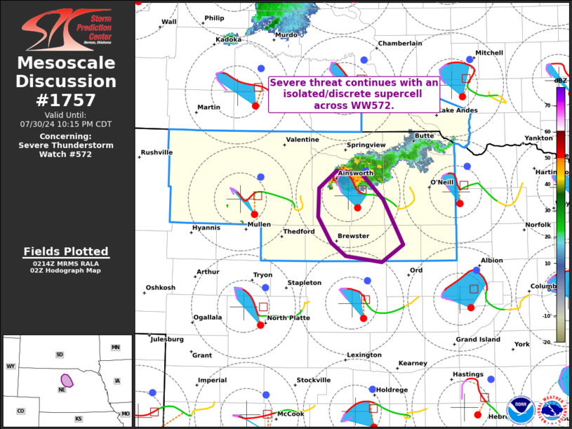
   Areas affected...Portions of north-central Nebraska

   Concerning...Severe Thunderstorm Watch 572...

   Valid 310216Z - 310315Z

   The severe weather threat for Severe Thunderstorm Watch 572
   continues.

   SUMMARY...Severe threat, including potential for brief tornadoes,
   large hail, and locally damaging winds continues with an
   isolated/discrete supercell in north-central Nebraska.

   DISCUSSION...The severe threat across Severe Thunderstorm Watch 572
   is now confined to portions of north-central Nebraska -- where a
   persistent discrete supercell is tracking south-southeastward at
   around 25 kt. A confirmed tornado was reported with this storm at
   around 02Z, and the potential for brief tornadoes, large hail, and
   locally damaging winds will continue as the storm continues
   south-southeastward. The maintenance of this storm will be aided by
   extreme surface-based buoyancy (see LBF 00Z sounding) and modest
   clockwise hodograph curvature (around 130 m2/s2 0-1km SRH per UEX
   VWP).

   ..Weinman.. 07/31/2024

   ...Please see www.spc.noaa.gov for graphic product...

   ATTN...WFO...LBF...

   LAT...LON   42160009 42440009 42629986 42589953 42349924 41909899
               41729926 41799974 41929992 42160009
|
|
Top/All Mesoscale Discussions/Forecast Products/Home
|
|


