|
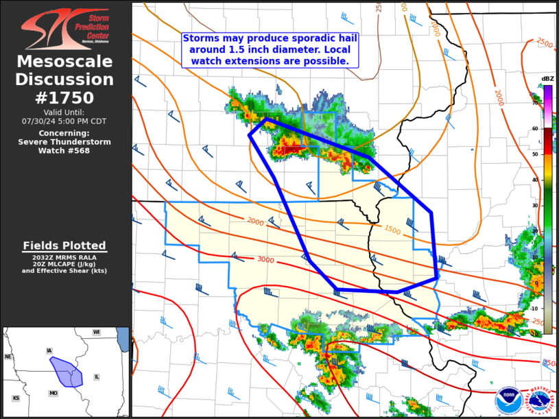
| Mesoscale Discussion 1750 |
|
< Previous MD Next MD >
|

|
   Mesoscale Discussion 1750
   NWS Storm Prediction Center Norman OK
   0336 PM CDT Tue Jul 30 2024

   Areas affected...southeast IA...northeast MO...and west-central IL

   Concerning...Severe Thunderstorm Watch 568...

   Valid 302036Z - 302200Z

   The severe weather threat for Severe Thunderstorm Watch 568
   continues.

   SUMMARY...Isolated cells may produce sporadic large hail to around
   1.5 inches in diameter over the next couple of hours. Local
   extensions of WW 568 are possible.

   DISCUSSION...A band of supercells has persisted across southeast IA
   in a modest warm advection regime atop a capped boundary-layer.
   Moderate instability exists downstream, along with favorable
   vertical shear. However, multiple rounds of convection have impacted
   parts of the area in the past 12 hours. This will likely preclude
   upscale development, though some hail and gusty wind risk may linger
   for a couple more hours. WW 568 is set to expire at 21z, though
   local watch extensions are possible.

   ..Leitman.. 07/30/2024

   ...Please see www.spc.noaa.gov for graphic product...

   ATTN...WFO...ILX...LSX...DVN...DMX...EAX...

   LAT...LON   41449288 41049150 40479066 39809060 39679112 39709193
               39989228 40839277 41269311 41449288
|
|
Top/All Mesoscale Discussions/Forecast Products/Home
|
|


