|
| Mesoscale Discussion 1744 |
|
< Previous MD Next MD >
|

|
   Mesoscale Discussion 1744
   NWS Storm Prediction Center Norman OK
   1208 PM CDT Tue Jul 30 2024

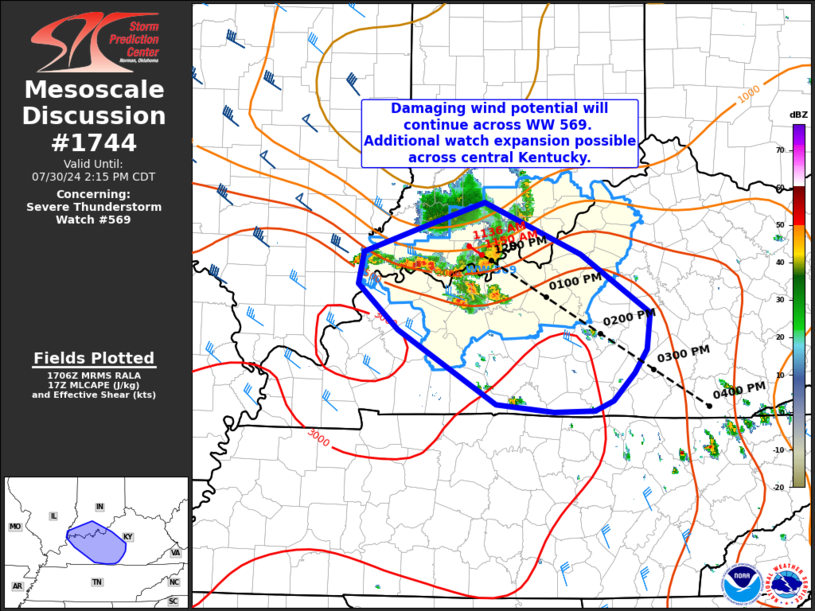
   Areas affected...southern Indiana into central Kentucky

   Concerning...Severe Thunderstorm Watch 569...

   Valid 301708Z - 301915Z

   The severe weather threat for Severe Thunderstorm Watch 569
   continues.

   SUMMARY...Damaging wind potential will continue and possibly
   increase over the next couple of hours. Additional watch expansion
   across central Kentucky may be needed.

   DISCUSSION...Additional storms are developing just ahead of a
   cluster near the Ohio River in a moderately unstable environment.
   Vertical shear is somewhat muted across central KY, however, locally
   enhanced shear associated with the cluster and embedded MCV will
   likely compensate for otherwise weaker background shear. This is
   evident in VWP data from KVWX where rear inflow of 45-55 kt is noted
   between 4-6 km. This should aid in continued organized strong to
   severe convection as these storms track southeast around 35 kt.
   Damaging wind will continue to be the main hazard with this
   activity, and additional expansion of Severe thunderstorm Watch 569
   across central Kentucky is possible.

   ..Leitman/Gleason.. 07/30/2024

   ...Please see www.spc.noaa.gov for graphic product...

   ATTN...WFO...LMK...IND...PAH...

   LAT...LON   38558666 38088558 37548479 37228484 37008498 36758521
               36678542 36668589 36728654 37408765 37808810 38108804
               38298747 38558666
|
|
Top/All Mesoscale Discussions/Forecast Products/Home
|
|


