|
| Mesoscale Discussion 1737 |
|
< Previous MD Next MD >
|

|
   Mesoscale Discussion 1737
   NWS Storm Prediction Center Norman OK
   0123 AM CDT Tue Jul 30 2024

   Areas affected...southern OH

   Concerning...Severe potential...Watch unlikely

   Valid 300623Z - 300800Z

   Probability of Watch Issuance...5 percent

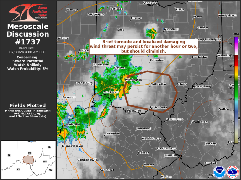
   SUMMARY...A brief tornado and localized damaging wind threat may
   persist for a another hour or two with a cluster moving
   east-southeast across a portion of southern Ohio. Overall threat is
   expected to subside before dawn.

   DISCUSSION...A cluster intensified last hour over southwest OH with
   at least one TDS noted just southwest of the ILN radar into Clinton
   County. A surge in IR cloud top cooling occurred just before this
   TDS and has since warmed, but transient mesovortices remain possible
   along the leading edge of the gust front. While there is adequate
   low-level shear in the ILN VWP data, weaker flow with minimal change
   in direction has persisted above 1 km AGL, suggesting long-term
   organizational potential will be limited. Downstream buoyancy is
   increasingly meager with eastern extent (below 500 J/kg) as this
   cluster progresses east-southeast at around 35 kts. As such, the
   brief tornado/localized damaging wind threat will probably diminish
   after about 08Z.

   ..Grams/Guyer.. 07/30/2024

   ...Please see www.spc.noaa.gov for graphic product...

   ATTN...WFO...RLX...ILN...

   LAT...LON   39588368 39718305 39628232 39168206 38818223 38648254
               38728303 38848370 39238385 39588368
|
|
Top/All Mesoscale Discussions/Forecast Products/Home
|
|


