|
| Mesoscale Discussion 1728 |
|
< Previous MD Next MD >
|

|
   Mesoscale Discussion 1728
   NWS Storm Prediction Center Norman OK
   0338 PM CDT Mon Jul 29 2024

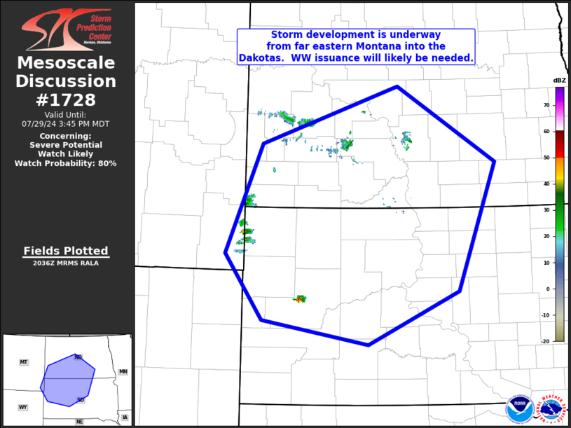
   Areas affected...far southeastern Montana eastward to the central
   Dakotas

   Concerning...Severe potential...Watch likely

   Valid 292038Z - 292145Z

   Probability of Watch Issuance...80 percent

   SUMMARY...Isolated storm development is occurring from far
   southeastern Montana into west-central South Dakota, and should
   increase across the western and central Dakotas over the next 1 to 2
   hours.  WW issuance may be needed in the next hour.

   DISCUSSION...Latest visible satellite and radar imagery show a lone
   thunderstorm developing over Meade County in South Dakota, and
   TCU/CB growth over far southeastern Montana along the southwestern
   North Dakota/northwestern South Dakota border area.  The convection
   is developing on the western fringe of the CAPE axis, with 1000 to
   2000 J/kg mixed-layer CAPE observed either side of the North
   Dakota/South Dakota border.

   Storm development -- though overall coverage appears likely to
   remain widely scattered -- is expected to increase over the next 1
   to 2 hours.  Though low-level flow remains weak across the area,
   moderate mid-level flow is contributing to sufficient shear for
   organized/rotating updrafts.  Presuming sufficient storm coverage
   evolves, risk for damaging winds and hail with the stronger cells
   will likely warrant WW issuance -- perhaps within the next hour or
   so.

   ..Goss/Gleason.. 07/29/2024

   ...Please see www.spc.noaa.gov for graphic product...

   ATTN...WFO...ABR...BIS...UNR...BYZ...

   LAT...LON   44260364 45250443 46880368 47740077 46609870 44689950
               43890141 44260364
|
|
Top/All Mesoscale Discussions/Forecast Products/Home
|
|


