|
| Mesoscale Discussion 1727 |
|
< Previous MD Next MD >
|

|
   Mesoscale Discussion 1727
   NWS Storm Prediction Center Norman OK
   0325 PM CDT Mon Jul 29 2024

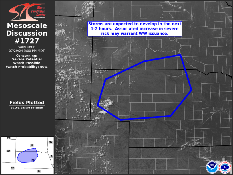
   Areas affected...the Nebraska Panhandle...eastward to south-central
   South Dakota and central Nebraska

   Concerning...Severe potential...Watch possible

   Valid 292025Z - 292300Z

   Probability of Watch Issuance...40 percent

   SUMMARY...Storm development expected in the next 60 to 90 minutes is
   expected, with an associated increase in severe potential
   thereafter.  WW issuance may be required.

   DISCUSSION...Latest visible satellite imagery shows gradual
   evolution of TCU/small CB from the increasing cu field across
   eastern Wyoming and into western portions of the Nebraska Panhandle.
    The convection is developing with a modestly unstable environment,
   but greater CAPE is indicated with eastward extent toward central
   Nebraska/south-central South Dakota, where 1000 to 2000 J/kg
   mixed-layer CAPE is indicated.

   With that said, a rather dry environment is observed above the
   boundary layer -- confirmed by the special 19Z RAOB from KLBF
   showing only 1.05 PW.  As such, questions regarding coverage of
   stronger convection continue to linger.

   While weak low-level flow is indicated, cloud-layer shear is
   sufficient for updraft organization, as flow in the 500 to 300 mb
   layer increases from around 25 kt to around 50 kt.  This suggests
   that any storm which can become sustained, will be capable of
   producing hail and damaging gusts.  Depending upon the degree of
   convective development and eventual coverage of robust storms, WW
   issuance may be required.

   ..Goss/Gleason.. 07/29/2024

   ...Please see www.spc.noaa.gov for graphic product...

   ATTN...WFO...FSD...ABR...LBF...UNR...CYS...

   LAT...LON   41590368 42600330 43320130 43579936 42209881 41219992
               41050251 41590368
|
|
Top/All Mesoscale Discussions/Forecast Products/Home
|
|


