|
| Mesoscale Discussion 1717 |
|
< Previous MD Next MD >
|

|
   Mesoscale Discussion 1717
   NWS Storm Prediction Center Norman OK
   0612 PM CDT Sat Jul 27 2024

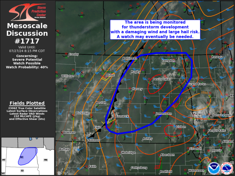
   Areas affected...Portions of central/eastern North Dakota into far
   northwestern Minnesota

   Concerning...Severe potential...Watch possible

   Valid 272312Z - 280115Z

   Probability of Watch Issuance...40 percent

   SUMMARY...The area is being monitored for thunderstorm development,
   with a risk of damaging winds and large hail. A watch may eventually
   be needed for parts of the area.

   DISCUSSION...As of 2300Z, the KBIS/KMBX radars show increasing
   surface convergence along a NNW/SSE-oriented cold front draped
   across central North Dakota. Boundary-layer cumulus is also
   expanding in coverage and deepening along the front, generally
   along/south of I-94. Given a warm/moist and uncapped pre-convective
   air mass, isolated to widely scattered thunderstorm development is
   expected along the front in the next hour or so.

   Steep midlevel lapse rates (associated with an EML) above the
   warm/moist boundary layer are contributing to moderate surface-based
   instability ahead of the front. This, combined with around 35 kt of
   west-southwesterly effective shear (oriented oblique to the front),
   will support a mix of organized clusters and semi-discrete
   supercells. Large hail (generally up to 1.75 inches) and locally
   damaging wind gusts (up to 70 mph) will be possible (especially with
   any initial semi-discrete supercells). With time, the damaging-wind
   risk may increase if storms can grow locally upscale as they track
   eastward.

   There is still some uncertainty on overall storm coverage and
   longevity (given fairly weak large-scale ascent and gradually
   increasing nocturnal static stability). Trends are being monitored
   for a possible watch issuance for parts of the area this evening.

   ..Weinman/Hart.. 07/27/2024

   ...Please see www.spc.noaa.gov for graphic product...

   ATTN...WFO...FGF...BIS...

   LAT...LON   48130053 48849985 49019944 49099864 49089708 48809676
               48239683 47429765 46629885 46349982 46260062 46340100
               46470118 46790122 47370094 48130053
|
|
Top/All Mesoscale Discussions/Forecast Products/Home
|
|


