|
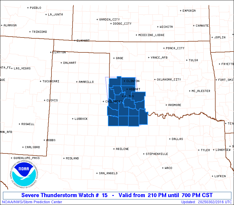
Initial List of Counties in SPC Severe Thunderstorm Watch 15 (WOU)
|
Back to Watch 15
|
 |
   WOUS64 KWNS 022010
   WOU5

   BULLETIN - IMMEDIATE BROADCAST REQUESTED
   SEVERE THUNDERSTORM WATCH OUTLINE UPDATE FOR WS 15
   NWS STORM PREDICTION CENTER NORMAN OK
   210 PM CST SUN MAR 2 2025

   SEVERE THUNDERSTORM WATCH 15 IS IN EFFECT UNTIL 700 PM CST
   FOR THE FOLLOWING LOCATIONS

   OKC009-031-033-055-057-065-075-141-149-030100-
   /O.NEW.KWNS.SV.A.0015.250302T2010Z-250303T0100Z/

   OK
   .    OKLAHOMA COUNTIES INCLUDED ARE

   BECKHAM              COMANCHE            COTTON
   GREER                HARMON              JACKSON
   KIOWA                TILLMAN             WASHITA


   TXC009-023-077-155-197-275-485-487-030100-
   /O.NEW.KWNS.SV.A.0015.250302T2010Z-250303T0100Z/

   TX
   .    TEXAS COUNTIES INCLUDED ARE

   ARCHER               BAYLOR              CLAY
   FOARD                HARDEMAN            KNOX
   WICHITA              WILBARGER


   ATTN...WFO...OUN...
|
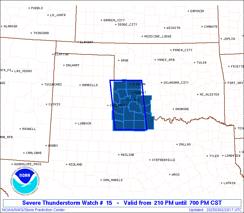
| Aviation Watch (SAW) for WW15 |
|---|
 |
| Note:
The Aviation Watch (SAW) product is an approximation to the watch area.
The actual watch is depicted by the shaded areas. |
   SAW5
   WW 15 SEVERE TSTM OK TX 022010Z - 030100Z
   AXIS..45 STATUTE MILES EAST AND WEST OF LINE..
   15NW CSM/CLINTON OK/ - 50SW SPS/WICHITA FALLS TX/
   ..AVIATION COORDS.. 40NM E/W /57SSE MMB - 41SW SPS/
   HAIL SURFACE AND ALOFT..1.5 INCHES. WIND GUSTS..60 KNOTS.
   MAX TOPS TO 400. MEAN STORM MOTION VECTOR 22035.

   LAT...LON 35489859 33459833 33459989 35480019

   THIS IS AN APPROXIMATION TO THE WATCH AREA.  FOR A
   COMPLETE DEPICTION OF THE WATCH SEE WOUS64 KWNS
   FOR WOU5.
|
|


 @NWSSPC