|
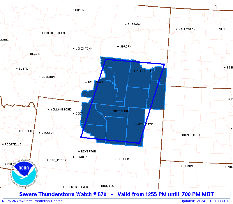
Initial List of Counties in SPC Severe Thunderstorm Watch 670 (WOU)
|
Back to Watch 670
|
 |
   WOUS64 KWNS 121856
   WOU0

   BULLETIN - IMMEDIATE BROADCAST REQUESTED
   SEVERE THUNDERSTORM WATCH OUTLINE UPDATE FOR WS 670
   NWS STORM PREDICTION CENTER NORMAN OK
   1255 PM MDT THU SEP 12 2024

   SEVERE THUNDERSTORM WATCH 670 IS IN EFFECT UNTIL 700 PM MDT
   FOR THE FOLLOWING LOCATIONS

   MTC003-011-017-025-075-087-103-130100-
   /O.NEW.KWNS.SV.A.0670.240912T1855Z-240913T0100Z/

   MT
   .    MONTANA COUNTIES INCLUDED ARE

   BIG HORN             CARTER              CUSTER
   FALLON               POWDER RIVER        ROSEBUD
   TREASURE


   WYC003-005-019-033-043-130100-
   /O.NEW.KWNS.SV.A.0670.240912T1855Z-240913T0100Z/

   WY
   .    WYOMING COUNTIES INCLUDED ARE

   BIG HORN             CAMPBELL            JOHNSON
   SHERIDAN             WASHAKIE


   ATTN...WFO...BYZ...RIW...UNR...
|
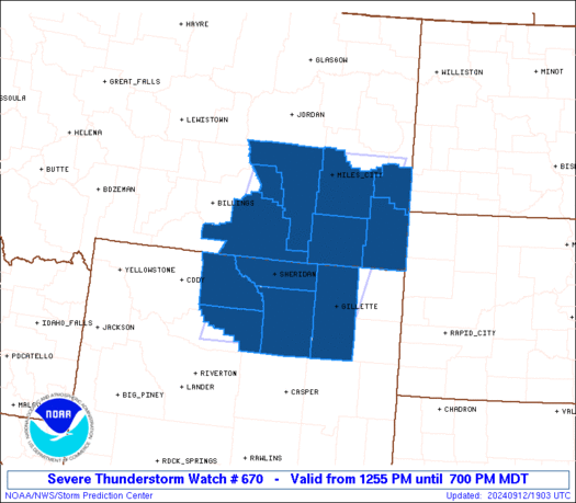
| Aviation Watch (SAW) for WW670 |
|---|
 |
| Note:
The Aviation Watch (SAW) product is an approximation to the watch area.
The actual watch is depicted by the shaded areas. |
   SAW0
   WW 670 SEVERE TSTM MT WY 121855Z - 130100Z
   AXIS..80 STATUTE MILES EAST AND WEST OF LINE..
   60ESE WRL/WORLAND WY/ - 25N MLS/MILES CITY MT/
   ..AVIATION COORDS.. 70NM E/W /29SW CZI - 25N MLS/
   HAIL SURFACE AND ALOFT..1.5 INCHES. WIND GUSTS..65 KNOTS.
   MAX TOPS TO 450. MEAN STORM MOTION VECTOR 22040.

   LAT...LON 43620846 46780757 46780419 43620526

   THIS IS AN APPROXIMATION TO THE WATCH AREA.  FOR A
   COMPLETE DEPICTION OF THE WATCH SEE WOUS64 KWNS
   FOR WOU0.
|
|


 @NWSSPC