|
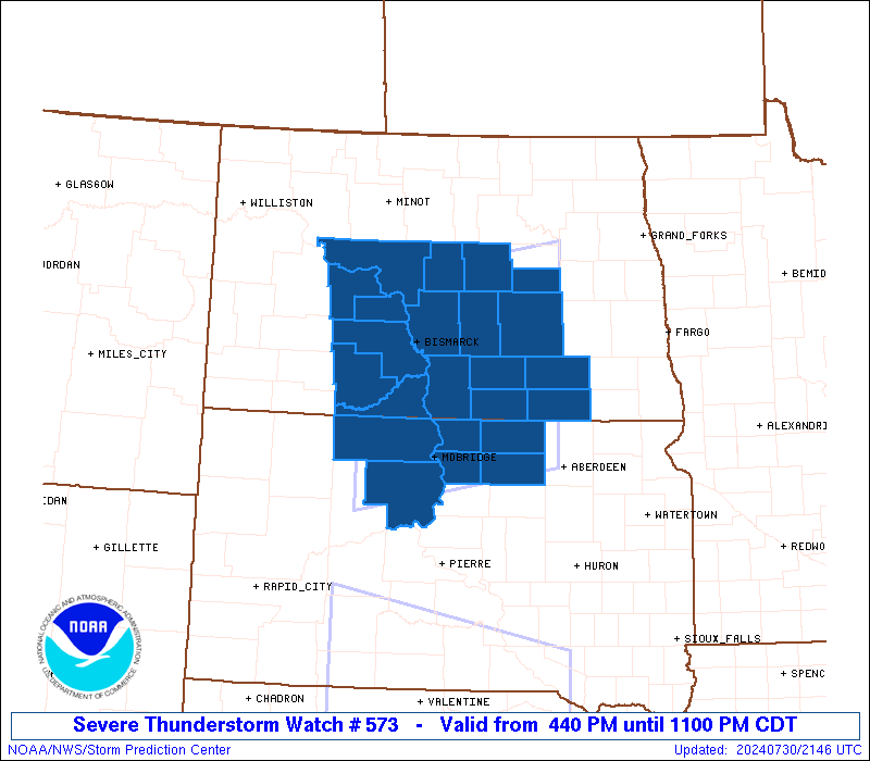
Initial List of Counties in SPC Severe Thunderstorm Watch 573 (WOU)
|
Back to Watch 573
|
 |
   WOUS64 KWNS 302135
   WOU3

   BULLETIN - IMMEDIATE BROADCAST REQUESTED
   SEVERE THUNDERSTORM WATCH OUTLINE UPDATE FOR WS 573
   NWS STORM PREDICTION CENTER NORMAN OK
   440 PM CDT TUE JUL 30 2024

   SEVERE THUNDERSTORM WATCH 573 IS IN EFFECT UNTIL 1100 PM CDT
   FOR THE FOLLOWING LOCATIONS

   NDC015-021-029-031-037-043-045-047-051-055-057-059-065-083-085-
   093-103-310400-
   /O.NEW.KWNS.SV.A.0573.240730T2140Z-240731T0400Z/

   ND
   .    NORTH DAKOTA COUNTIES INCLUDED ARE

   BURLEIGH             DICKEY              EMMONS
   FOSTER               GRANT               KIDDER
   LAMOURE              LOGAN               MCINTOSH
   MCLEAN               MERCER              MORTON
   OLIVER               SHERIDAN            SIOUX
   STUTSMAN             WELLS


   SDC021-031-041-045-089-129-310400-
   /O.NEW.KWNS.SV.A.0573.240730T2140Z-240731T0400Z/

   SD
   .    SOUTH DAKOTA COUNTIES INCLUDED ARE

   CAMPBELL             CORSON              DEWEY
   EDMUNDS              MCPHERSON           WALWORTH


   ATTN...WFO...BIS...ABR...
|
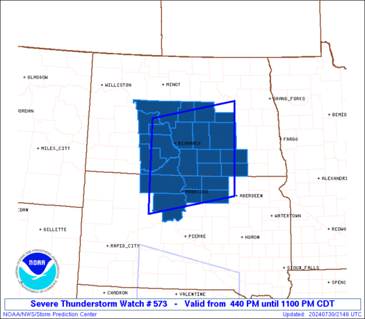
| Aviation Watch (SAW) for WW573 |
|---|
 |
| Note:
The Aviation Watch (SAW) product is an approximation to the watch area.
The actual watch is depicted by the shaded areas. |
   SAW3
   WW 573 SEVERE TSTM ND SD 302140Z - 310400Z
   AXIS..85 STATUTE MILES NORTH AND SOUTH OF LINE..
   60SW BIS/BISMARCK ND/ - 20SSE JMS/JAMESTOWN ND/
   ..AVIATION COORDS.. 75NM N/S /54SW BIS - 69W FAR/
   HAIL SURFACE AND ALOFT..2 INCHES. WIND GUSTS..60 KNOTS.
   MAX TOPS TO 500. MEAN STORM MOTION VECTOR 27025.

   LAT...LON 47390164 47899852 45439852 44930164

   THIS IS AN APPROXIMATION TO THE WATCH AREA.  FOR A
   COMPLETE DEPICTION OF THE WATCH SEE WOUS64 KWNS
   FOR WOU3.
|
|


 @NWSSPC