SPC AC 050531
Day 1 Convective Outlook
NWS Storm Prediction Center Norman OK
1131 PM CST Tue Feb 04 2025
Valid 051200Z - 061200Z
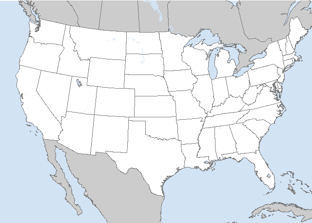
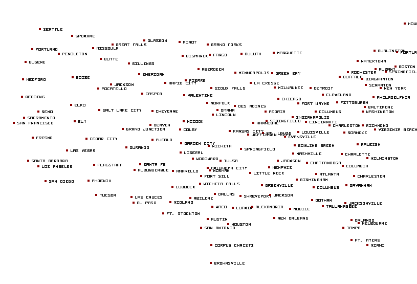
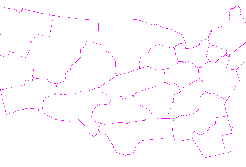
...THERE IS A MARGINAL RISK OF SEVERE THUNDERSTORMS ACROSS PARTS OF
TENNESSEE AND KENTUCKY...
...SUMMARY...
Thunderstorms with isolated severe gusts will be possible this
afternoon and evening across parts of Tennessee and Kentucky.
...Tennessee/Kentucky...
A mid-level shortwave trough will move eastward across the central
U.S. today, as an associated jet streak translates eastward through
the central Plains. In response, a low-level jet will gradually
strengthen across the Ozarks today. At the surface, a warm front
will move northward across the Tennessee Valley this afternoon and
into the Ohio Valley this evening. Scattered thunderstorms are
expected to develop along and to the south of the warm front near
the eastern edge of the low-level jet. This convection is forecast
to expand in coverage as large-scale ascent increases ahead of the
approaching trough. Surface dewpoints near the front should be in
the 50s F, with instability remaining weak during the day due to
abundant cloud cover. In spite of this, deep-layer shear will be
strong, with a notable increase in shear taking place as the exit
region of the mid-level jet overspreads the Ohio Valley early this
evening. RAP forecast soundings near the warm front from 00Z to
02Z/Thursday across southern Kentucky and northern Tennessee have
MUCAPE between 500 and 1000 J/kg, 0-6 km shear in the 50 to 60 knot
range, and 700 to 500 mb lapse rates approaching 7 C/km. This
environment could be enough for an isolated severe threat. If
surface-based cells can initiate near or to the south of the front,
a few severe gusts and a brief tornado spinup would be possible.
However, a near-surface inversion is present on many of the forecast
soundings along the warm front. This will likely be a negative
factor for the severe threat, keeping any severe potential localized
and marginal.
..Broyles/Lyons.. 02/05/2025
CLICK TO GET WUUS01 PTSDY1 PRODUCT
NOTE: THE NEXT DAY 1 OUTLOOK IS SCHEDULED BY 1300Z


 @NWSSPC