|
| Mesoscale Discussion 192 |
|
< Previous MD Next MD >
|
|
Mesoscale Discussion 0192
NWS Storm Prediction Center Norman OK
0203 AM CDT Sat Mar 15 2025
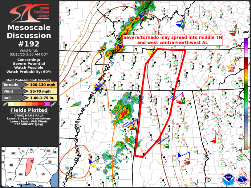
Areas affected...Western middle Tennessee into west
central/northwest Alabama
Concerning...Severe potential...Watch possible
Valid 150703Z - 150830Z
Probability of Watch Issuance...60 percent
SUMMARY...Severe/tornado threat may spread into parts of middle
Tennessee and west central/northwest Alabama through the early
morning. A new tornado watch may be needed.
DISCUSSION...Warm sector supercells, including a long-lived tornadic
storm in northeast MS, will continue to spread northeastward along
the east edge of the richer low-level moisture. Low-level
trajectories from the south and south-southeast suggest that
moisture increases into AL and middle TN will be gradual. However,
near-surface moistening will be sufficient to maintain the storm
clusters, along with some continued tornado threat near and a little
east of the longitude of the MS/AL border. This area will continue
to be monitored for the possibility of a new tornado watch by
roughly 08z.
..Thompson/Smith.. 03/15/2025
...Please see www.spc.noaa.gov for graphic product...
ATTN...WFO...LMK...OHX...BMX...HUN...PAH...MEG...
LAT...LON 36598590 35088643 33928673 33058722 32338799 32388836
33778817 35088804 36048788 36668730 36598590
|
|
Top/All Mesoscale Discussions/Forecast Products/Home
|
|


 @NWSSPC