|
| Mesoscale Discussion 169 |
|
< Previous MD Next MD >
|
|
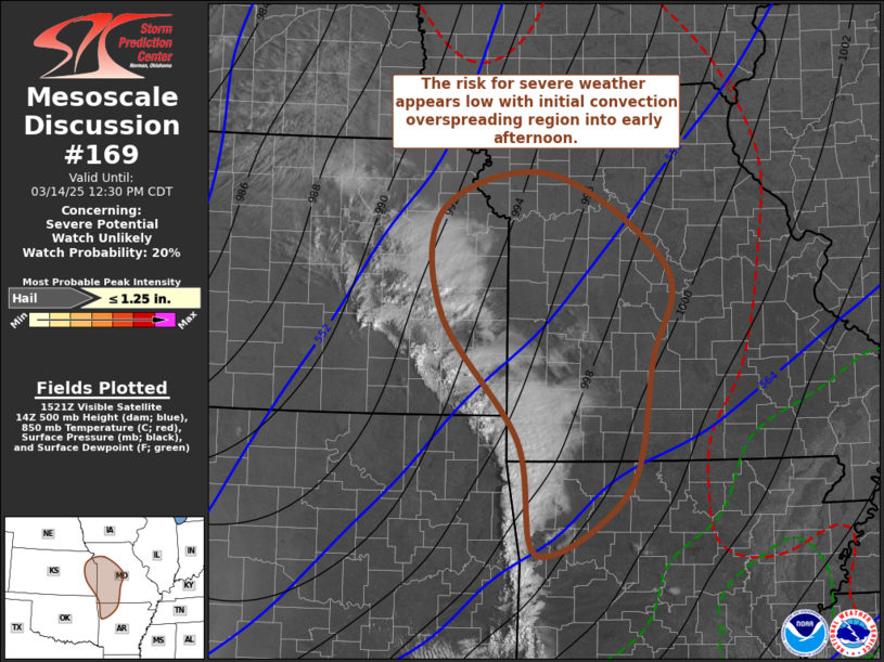
   Mesoscale Discussion 0169
   NWS Storm Prediction Center Norman OK
   1025 AM CDT Fri Mar 14 2025

   Areas affected...parts of eastern Kansas....western
   Missouri...northwestern Arkansas

   Concerning...Severe potential...Watch unlikely

   Valid 141525Z - 141730Z

   Probability of Watch Issuance...20 percent

   SUMMARY...An initial round of convective development is expected to
   remain sub-severe as it spreads northeastward across parts of
   western Missouri and northwestern Arkansas through early afternoon.

   DISCUSSION...Thunderstorm activity has initiated during the past few
   hours across parts of southeastern Kansas into northeastern
   Oklahoma.  This is occurring within the evolving warm sector of
   broad and deep, occluding cyclone over central portions of the high
   plains.  However, this appears to be rooted above a stable
   boundary-layer, where a narrow corridor of modest
   lower/mid-tropospheric moisture return is ongoing, in advance of the
   leading edge of an initial surge of mid-level cooling overspreading
   the central and southern Great Plains.

   Based within, just above, steeper lapse rates associated with a
   plume of elevated mix-layer air, CAPE is weak and inhibition remains
   otherwise sizable.  Some small hail might be possible in the more
   vigorous cells.  However, the risk for severe weather is expected to
   remain minimal with this initial convection, and it remains unclear
   how long it will persist.

   ..Kerr/Gleason.. 03/14/2025

   ...Please see www.spc.noaa.gov for graphic product...

   ATTN...WFO...LSX...LZK...SGF...EAX...TSA...TOP...ICT...

   LAT...LON   38129553 39279549 39629400 38609240 37579261 36179295
               35469419 36739448 38129553
|
|
Top/All Mesoscale Discussions/Forecast Products/Home
|
|


 @NWSSPC