|
| Mesoscale Discussion 137 |
|
< Previous MD Next MD >
|
|
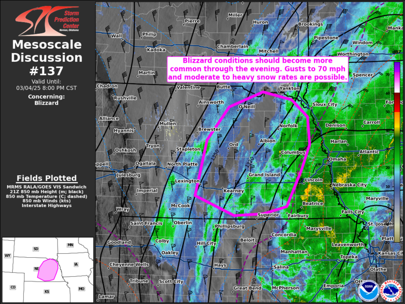
   Mesoscale Discussion 0137
   NWS Storm Prediction Center Norman OK
   0506 PM CST Tue Mar 04 2025

   Areas affected...portions of central into eastern Nebraska

   Concerning...Blizzard

   Valid 042306Z - 050200Z

   SUMMARY...Blizzard conditions are possible over the next few hours.
   Moderate to heavy snowfall rates may occur with northwesterly
   surface winds sustaining over 40 mph, perhaps gusting to 70 mph.
   Visibility may drop to a quarter mile in spots.

   DISCUSSION...A surface low along the KS/MO border continues to
   deepen while shifting towards the Great Lakes, promoting a broad,
   intense northwesterly surface wind field over parts of the central
   Plains. Surface observations show northwesterly surface winds
   sustaining to 40 mph at times over parts of central/eastern NE,
   where measured gusts have exceeded 65 mph. In tandem with these
   intense winds are developing snow-bands, as surface-700 mb cold-air
   advection continues to cool the column to temperatures below
   freezing. The surface low should continue to intensify through the
   evening as snowfall rates gradually increase. The current
   expectation is for blizzard conditions and reduced visibility to
   gradually become more common through the evening.

   ..Squitieri.. 03/04/2025

   ...Please see www.spc.noaa.gov for graphic product...

   ATTN...WFO...FSD...OAX...GID...LBF...

   LAT...LON   40519989 41779955 42539890 42879786 42699700 42299652
               41679647 41099672 40289718 40119787 40089873 40519989
|
|
Top/All Mesoscale Discussions/Forecast Products/Home
|
|


 @NWSSPC