|
| Mesoscale Discussion 123 |
|
< Previous MD Next MD >
|
|
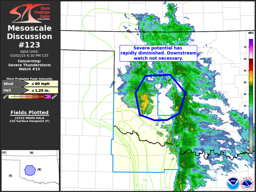
   Mesoscale Discussion 0123
   NWS Storm Prediction Center Norman OK
   0534 PM CST Sun Mar 02 2025

   Areas affected...portions of western OK

   Concerning...Severe Thunderstorm Watch 15...

   Valid 022334Z - 030030Z

   The severe weather threat for Severe Thunderstorm Watch 15
   continues.

   SUMMARY...Severe potential has rapidly diminished late this
   afternoon across western Oklahoma. A new watch downstream from
   Severe Thunderstorm Watch 15 is not expected.

   DISCUSSION...Convection has continued to weaken with north and east
   extent across southwest/western OK this afternoon. As thunderstorm
   continue to shift northeast toward central OK, low-level moisture
   will rapidly decrease in tandem with weakening midlevel lapse rates.
   Together this will result in meager elevated instability
   insufficient for maintaining deep updrafts supporting severe
   convection. As such, a downstream watch is not expected and WW 15
   will either be cancelled early or allowed to expire as scheduled at
   7pm CST.

   ..Leitman.. 03/02/2025

   ...Please see www.spc.noaa.gov for graphic product...

   ATTN...WFO...OUN...

   LAT...LON   35869900 35899823 35429774 34919794 34749832 34729871
               34879918 35439931 35869900
|
|
Top/All Mesoscale Discussions/Forecast Products/Home
|
|


 @NWSSPC