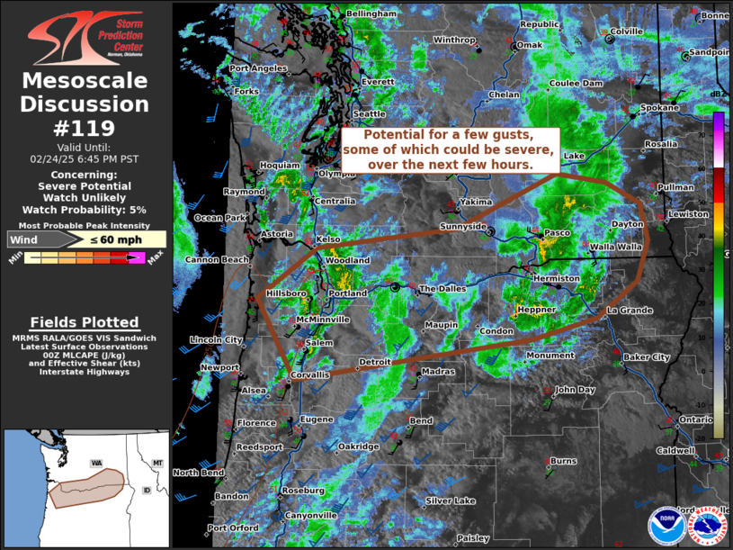
   Mesoscale Discussion 0119
   NWS Storm Prediction Center Norman OK
   0643 PM CST Mon Feb 24 2025

   Areas affected...Northern Oregon...Southern Washington

   Concerning...Severe potential...Watch unlikely

   Valid 250043Z - 250245Z

   Probability of Watch Issuance...5 percent

   SUMMARY...Potential for a few gusts, some of which could be severe,
   over the next few hours.

   DISCUSSION...Thunderstorm activity is ongoing, with two more
   organized bands noted near the Portland Metro and across the
   Columbia Gorge. Though thermal profiles are poor, strong upper level
   forcing from a mid-level jet max is overspreading the region amid
   some MLCAPE around 100-240 J/kg. The increase in winds aloft can be
   noted in the VAD from RTX (Portland, OR), where speeds up to 50-60
   kts are observed in the bottom 3 km. A few gusts around 50 mph were
   observed earlier in reporting sites near the Oregon coast. Steep low
   to mid-level lapse rates are also in place regionally, with forecast
   soundings from the NAM/RAP suggesting profiles are deeply mixed.
   This will allow for potential for even low topped showers to mix
   down higher momentum gusts at times, some of which may approach
   severe limits. Given the rapid loss of daytime heating and poor
   thermal environment, this is expected to remain localized and a
   watch is unlikely to be needed.

   ..Thornton/Guyer.. 02/25/2025

   ...Please see www.spc.noaa.gov for graphic product...

   ATTN...WFO...OTX...PDT...PQR...

   LAT...LON   45522382 46112285 46352052 46991884 46871803 46621746
               46201733 45731752 45311821 45071927 44862103 44582318
               45522382
|


 @NWSSPC