|
| Mesoscale Discussion 46 |
|
< Previous MD Next MD >
|
|
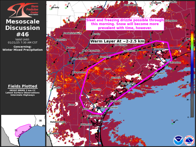
   Mesoscale Discussion 0046
   NWS Storm Prediction Center Norman OK
   0256 AM CST Tue Jan 21 2025

   Areas affected...Portions of the Middle and Upper Texas Coast
   Vicinity

   Concerning...Winter mixed precipitation

   Valid 210856Z - 211330Z

   SUMMARY...A mix of sleet and light freezing rain/drizzle will remain
   possible through daybreak. A gradual shift to snow (from north to
   south) will also occur with time.

   DISCUSSION...A mix of winter precipitation continues within and
   north the Middle/Upper Texas Coast regions. Based on reported
   precipitation and model sounding data, a mixture of sleet and
   lighter freezing rain/drizzle is most likely. Given the presence of
   steep lapse rates at cloud top (both noted in regional observed
   soundings and model soundings), some convective elements are
   possible and would be more efficient sleet producers. With time,
   additional large-scale ascent will cool the atmospheric column such
   that precipitation should continue to switch to all snow by daybreak
   and beyond. Should freezing rain/drizzle linger, this is most likely
   to be nearer the coast where the cold air may be shallow enough to
   support it.

   ..Wendt.. 01/21/2025

   ...Please see www.spc.noaa.gov for graphic product...

   ATTN...WFO...HGX...CRP...EWX...

   LAT...LON   28049692 27649732 27679765 27819799 28169817 29139788
               29569711 30089523 30039480 29439466 28049692
|
|
Top/All Mesoscale Discussions/Forecast Products/Home
|
|


 @NWSSPC