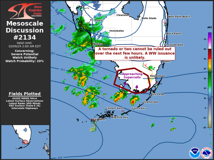
   Mesoscale Discussion 2134
   NWS Storm Prediction Center Norman OK
   1131 PM CDT Tue Oct 08 2024

   Areas affected...portions of the extreme southern Florida Peninsula

   Concerning...Severe potential...Watch unlikely

   Valid 090431Z - 090600Z

   Probability of Watch Issuance...20 percent

   SUMMARY...A couple of supercells may approach the extreme southern
   tip of the FL Peninsula over the next couple of hours, perhaps
   accompanied by a tornado threat. The severe threat should remain
   very localized, and a Tornado Watch issuance does not currently
   appear imminent.

   DISCUSSION...Pronounced supercell structures have materialized near
   a baroclinic boundary over FL Bay over the past hour or so, and are
   drifting north at around 5 kts. KBYX radar imagery depicts up to 35
   kt rotation velocities about 2500 ft AGL, suggesting that
   mesocyclonic waterspouts may be in progress. At the moment,
   hodographs on regional VADs do not appear overly impressive,
   suggesting that favorable low-level shear/SRH is likely constrained
   to small areas nearest to the baroclinic boundary. Furthermore,
   adequate instability appears to be constrained to mainly southern
   Monroe and Miami-Dade Counties. As such, any inland tornado
   potential realized by these supercells as they attempt to move
   ashore should be very limited in spatial extent, so a Tornado Watch
   issuance appears unlikely at this time. However, a Tornado Watch
   issuance will become more probable into the morning hours as the
   more favorable environment gradually expands and shifts northward.

   ..Squitieri/Edwards.. 10/09/2024

   ...Please see www.spc.noaa.gov for graphic product...

   ATTN...WFO...MFL...

   LAT...LON   25338128 25628120 25678082 25508051 25298046 25178056
               25138080 25338128
|


 @NWSSPC