|
| Mesoscale Discussion 2090 |
|
< Previous MD Next MD >
|

|
   Mesoscale Discussion 2090
   NWS Storm Prediction Center Norman OK
   0808 PM CDT Thu Sep 19 2024

   Areas affected...northern Wisconsin

   Concerning...Tornado Watch 678...

   Valid 200108Z - 200215Z

   The severe weather threat for Tornado Watch 678 continues.

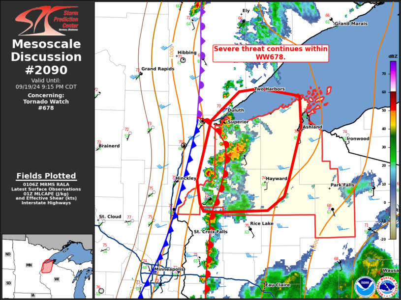
   SUMMARY...Severe threat continues within WW678.

   DISCUSSION...Thunderstorms continue within WW678 across northern WI.
   Storm mode has largely been supercellular, with weakening observed
   over the last hour. Storms are still within a region of MLCAPE
   around 1000 J/kg but may be responding to loss of daytime heating
   and warmer mid-levels. Shear profiles do remain favorable. The VAD
   profile from DLH continues to show low-level curvature and 0-3 km
   SRH around 160 m2/s2, favorable for maintaining supercells capable
   of instances of large hail and perhaps a tornado. However, the
   declining thermodynamic profile may not support this risk for much
   longer into the evening.

   ..Thornton.. 09/20/2024

   ...Please see www.spc.noaa.gov for graphic product...

   ATTN...WFO...DLH...MPX...

   LAT...LON   46029258 46699236 47029189 47059161 47069150 46979090
               46629089 46059108 45859116 45699144 45679218 45689247
               45769253 46029258
|
|
Top/All Mesoscale Discussions/Forecast Products/Home
|
|


