|
| Mesoscale Discussion 2022 |
|
< Previous MD Next MD >
|

|
   Mesoscale Discussion 2022
   NWS Storm Prediction Center Norman OK
   0829 PM CDT Tue Aug 27 2024

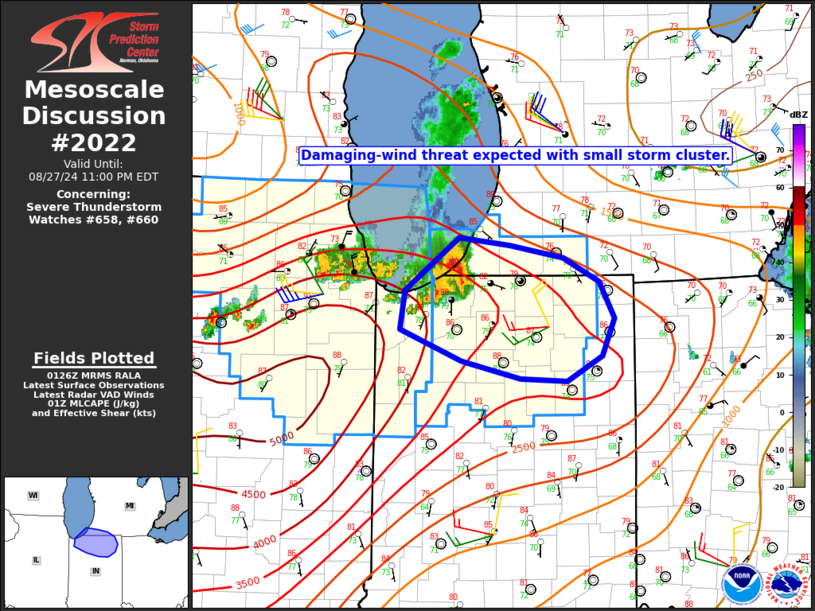
   Areas affected...Northern IN...southwest MI

   Concerning...Severe Thunderstorm Watch 658...660...

   Valid 280129Z - 280300Z

   The severe weather threat for Severe Thunderstorm Watch 658, 660
   continues.

   SUMMARY...The damaging-wind threat is expected to spread
   southeastward with a small storm cluster.

   DISCUSSION...A small storm cluster that formed from initial
   supercell development near/north of Chicago has accelerated
   southeastward and become better organized this evening, with rather
   strong velocities (60-70 kt at 3-5 km ARL) noted from KLOT/KIWX
   radars. While MLCINH increases with southeastward extent, strong
   buoyancy and the current organized nature of this cluster will
   continue to support a threat of severe/damaging gusts across a
   larger part of northern IN and southwest MI into late evening.
   Isolated hail will also be possible with the strongest embedded
   updrafts within this cluster.

   ..Dean.. 08/28/2024

   ...Please see www.spc.noaa.gov for graphic product...

   ATTN...WFO...IWX...LOT...

   LAT...LON   42068664 42008612 41908554 41708516 41418500 41128513
               40928551 40938599 41088662 41338727 41638722 42068664
|
|
Top/All Mesoscale Discussions/Forecast Products/Home
|
|


