|
| Mesoscale Discussion 2014 |
|
< Previous MD Next MD >
|

|
   Mesoscale Discussion 2014
   NWS Storm Prediction Center Norman OK
   0202 PM CDT Tue Aug 27 2024

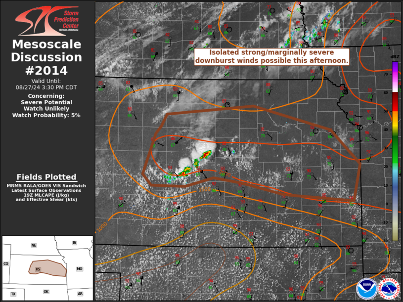
   Areas affected...Portions of central/eastern Kansas

   Concerning...Severe potential...Watch unlikely

   Valid 271902Z - 272030Z

   Probability of Watch Issuance...5 percent

   SUMMARY...Isolated strong/marginally severe winds and small hail are
   possible this afternoon in central/eastern Kansas. A watch is not
   likely.

   DISCUSSION...A few thunderstorms have initiated along an outflow
   boundary in central Kansas. Additional storms are possible farther
   east as heating continues this afternoon. Though deep-layer shear is
   weak, 1500-2000 J/kg MLCAPE will support isolated strong/marginally
   severe downburst winds as storms collapse. Small hail could occur as
   well, but warm temperatures in the profile and the mentioned weak
   shear should limit potential for marginally severe hail. Storms
   should have a tendency to move northward given the location of the
   upper-level ridge where continuing modification of the outflow
   should eventually support strong wind gusts.

   ..Wendt/Guyer.. 08/27/2024

   ...Please see www.spc.noaa.gov for graphic product...

   ATTN...WFO...SGF...EAX...TOP...ICT...GID...DDC...

   LAT...LON   37939636 38149732 38239796 38089859 38099937 38299956
               39029929 39149917 39369903 39539704 39099527 38469462
               37819478 37939636
|
|
Top/All Mesoscale Discussions/Forecast Products/Home
|
|


