|
| Mesoscale Discussion 2011 |
|
< Previous MD Next MD >
|

|
   Mesoscale Discussion 2011
   NWS Storm Prediction Center Norman OK
   0346 AM CDT Tue Aug 27 2024

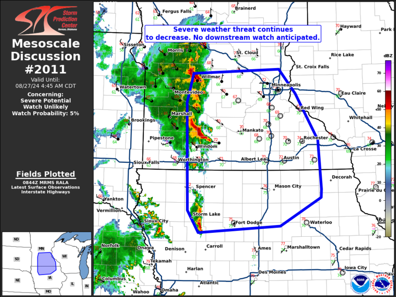
   Areas affected...southern and eastern MInnesota and northern Iowa.

   Concerning...Severe potential...Watch unlikely

   Valid 270846Z - 270945Z

   Probability of Watch Issuance...5 percent

   SUMMARY...The severe weather threat continues to decrease across
   portions of the Upper Midwest. No downstream watch is anticipated.

   DISCUSSION...A few strong to potentially severe storms moved through
   watch 654 over the past few hours and are now exiting eastern
   portions of the watch. Convective trends are down and as storms
   continue to outrun the better deep-layer shear, expect this trend to
   continue. Nonetheless, a very unstable airmass remains ahead of
   these storms (4000 J/kg MUCAPE across northern Iowa). Therefore,
   occasional stronger updrafts capable of isolated severe weather
   remain possible, albeit unlikely. Given the weakening trend, a
   downstream watch will not be issued east of watch 654.

   ..Bentley/Edwards.. 08/27/2024

   ...Please see www.spc.noaa.gov for graphic product...

   ATTN...WFO...ARX...MPX...DMX...FSD...

   LAT...LON   42369504 42769531 44719536 45249520 45319305 44889263
               44049208 43159202 42999203 42489303 42369504
|
|
Top/All Mesoscale Discussions/Forecast Products/Home
|
|


