|
| Mesoscale Discussion 1967 |
|
< Previous MD Next MD >
|
|
Mesoscale Discussion 1967
NWS Storm Prediction Center Norman OK
0255 PM CDT Wed Aug 21 2024
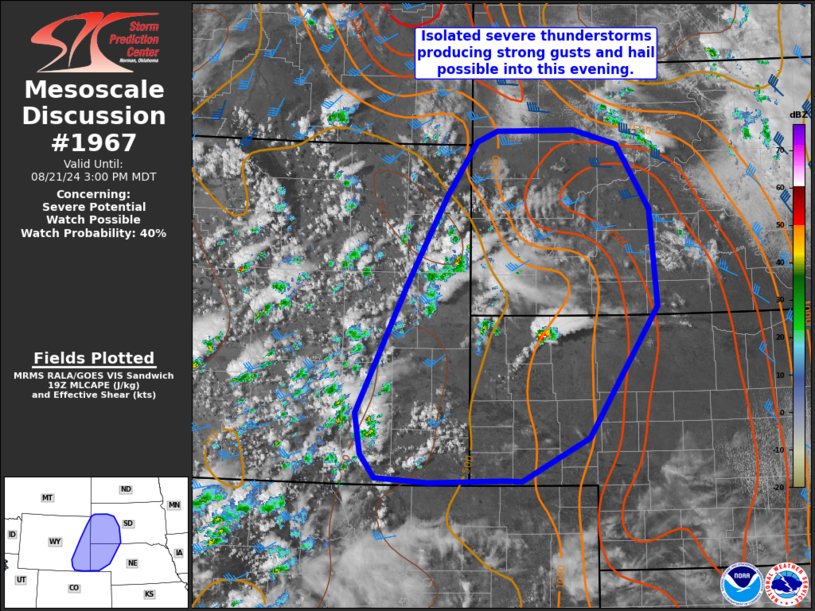
Areas affected...eastern WY into western SD/NE
Concerning...Severe potential...Watch possible
Valid 211955Z - 212100Z
Probability of Watch Issuance...40 percent
SUMMARY...Isolated strong to severe thunderstorms may produce gusts
of 55-70 mph and hail to 1.5 inches into this evening. Portions of
the area may need a severe thunderstorm watch, but timing is
uncertain.
DISCUSSION...Convection is increasing across WY and western SD/NE
this afternoon where strong heating into the 90s F has occurred.
Boundary-layer moisture remains modest across much of the area,
though 60s F dewpoints are noted into parts of SD. Cool temperatures
aloft, aiding in steep midlevel lapse rates, are supporting weak to
moderate instability across the region. High-based storms initially
developing near higher terrain may pose a risk for strong outflow
winds. Clustering may occur with eastward extent toward late
afternoon/early evening as storms move into a more moist and
unstable environment. Damaging gusts will be possible with this
activity. Additionally, modest vertical shear amid a steep lapse
rates environment could support a few instance of large hail in the
1-1.5 inch range with any stronger/longer-lived thunderstorm cores.
The MCD area is being monitored for possible watch issuance this
afternoon.
..Leitman/Hart.. 08/21/2024
...Please see www.spc.noaa.gov for graphic product...
ATTN...WFO...ABR...LBF...UNR...CYS...
LAT...LON 41060348 41020469 41070553 41350576 41830586 43370504
44390444 45020396 45150363 45170238 45000169 44230117
43100105 41550215 41040322 41060348
|
|
Top/All Mesoscale Discussions/Forecast Products/Home
|
|


 @NWSSPC