|
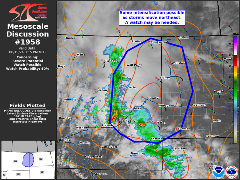
| Mesoscale Discussion 1958 |
|
< Previous MD Next MD >
|

|
   Mesoscale Discussion 1958
   NWS Storm Prediction Center Norman OK
   0244 PM CDT Mon Aug 19 2024

   Areas affected...Eastern Montana and western North Dakota.

   Concerning...Severe potential...Watch possible

   Valid 191944Z - 192115Z

   Probability of Watch Issuance...40 percent

   SUMMARY...Some intensification is possible as storms move northeast
   across eastern Montana. A watch may be needed.

   DISCUSSION...A slow moving cluster of storms has persisted across
   eastern Montana through most of the day today. Somewhat more robust
   convection has developed southeast of the primary cluster in the
   presence of greater instability (2000+ J/kg MLCAPE). SPC
   mesoanalysis shows inhibition has mostly eroded ahead of these
   storms and it should completely erode in the next 1 to 2 hours. A
   speed max overspread eastern Montana within the last hour (sampled
   40-45 knots between 4-5km on the GGW VWP). This increase in deep
   layer shear may support an increase in storm intensity later this
   afternoon. A few thunderstorms capable of large hail and severe wind
   gusts are expected this evening. A severe thunderstorm watch may be
   needed.

   ..Bentley/Hart.. 08/19/2024

   ...Please see www.spc.noaa.gov for graphic product...

   ATTN...WFO...BIS...UNR...BYZ...GGW...

   LAT...LON   45850479 45840523 46080584 46390631 46660628 47860617
               48570558 48940453 48670312 47360266 46180324 45800421
               45850479
|
|
Top/All Mesoscale Discussions/Forecast Products/Home
|
|


