|
| Mesoscale Discussion 1944 |
|
< Previous MD Next MD >
|

|
   Mesoscale Discussion 1944
   NWS Storm Prediction Center Norman OK
   0133 PM CDT Sun Aug 18 2024

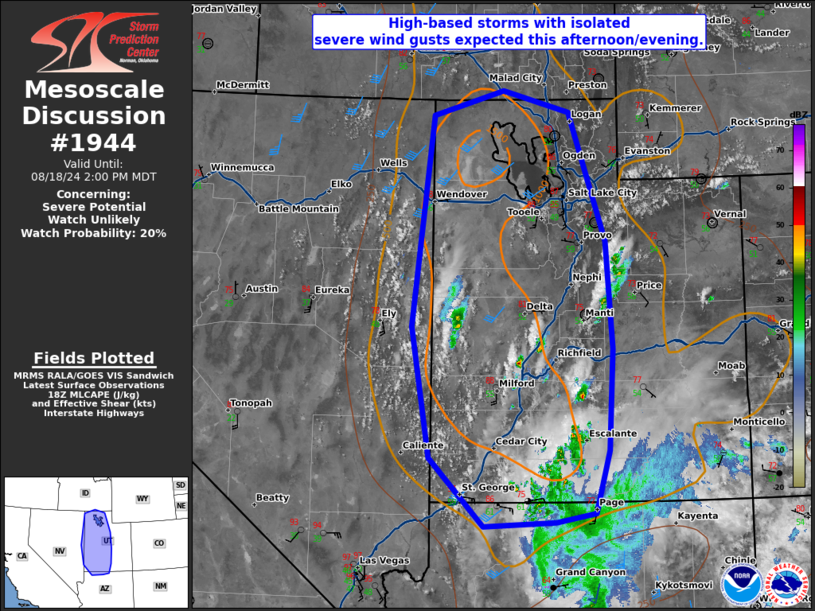
   Areas affected...western Utah

   Concerning...Severe potential...Watch unlikely

   Valid 181833Z - 182000Z

   Probability of Watch Issuance...20 percent

   SUMMARY...High-based storms with isolated severe wind gusts expected
   this afternoon/evening.

   DISCUSSION...A northward moving surge of tropical moisture is moving
   into southern Utah early this afternoon. Moderate instability has
   developed across western Utah where temperatures have warmed into
   the 80s. Expect at least scattered storm coverage this afternoon,
   but weak shear (15-25 knots per RAP forecast soundings) will be a
   limiting factor to storm organization. Nonetheless, given the
   deeply-mixed boundary layer, a few severe wind gusts will be
   possible this afternoon and evening.

   ..Bentley/Hart.. 08/18/2024

   ...Please see www.spc.noaa.gov for graphic product...

   ATTN...WFO...FGZ...SLC...PIH...VEF...LKN...

   LAT...LON   37541408 39181437 41801403 42101291 41841184 40231127
               38901116 37641123 36851145 36751208 36691321 37541408
|
|
Top/All Mesoscale Discussions/Forecast Products/Home
|
|


