|
| Mesoscale Discussion 1933 |
|
< Previous MD Next MD >
|
|
Mesoscale Discussion 1933
NWS Storm Prediction Center Norman OK
0257 PM CDT Sat Aug 17 2024
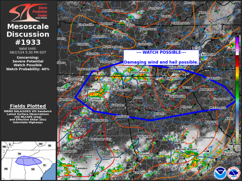
Areas affected...Southern Middle Tennessee...northern
Alabama...northern Georgia
Concerning...Severe potential...Watch possible
Valid 171957Z - 172130Z
Probability of Watch Issuance...40 percent
SUMMARY...Damaging wind and hail threat to persist through the
afternoon.
DISCUSSION...Recent thunderstorm activity across northern
Alabama/southern Tennessee into northern Georgia has shown increase
in intensity, with transient supercell characteristics. These are
occurring in the vicinity of a remnant MCV, which has led to a
narrow corridor of 30-40 kts of deep layer shear likely contributing
to a more organized storm mode. Temperatures in this region have
warmed into the low to mid 90s with dew points in the mid to upper
70s, with MLCAPE analyzed around 2000-2500 J/kg. This moist and
unstable air mass will support potential for wet downbursts and
perhaps a risk of large hail and damaging wind from stronger more
organized storms. This activity will likely continue to increase in
coverage, potentially clustering along outflow, into northern
Georgia and South Carolina through the afternoon/evening. Should
this occur, the risk of damaging wind may increase. The Slight Risk
has been expanded southward at 20z, and a watch may be needed to
cover this threat.
..Thornton/Hart.. 08/17/2024
...Please see www.spc.noaa.gov for graphic product...
ATTN...WFO...CAE...GSP...MRX...FFC...OHX...BMX...HUN...
LAT...LON 35138672 35488543 35308414 35208327 35018254 34648168
34198123 33968168 33868262 33598450 33868664 34298735
35138672
|
|
Top/All Mesoscale Discussions/Forecast Products/Home
|
|


 @NWSSPC