|
| Mesoscale Discussion 1930 |
|
< Previous MD Next MD >
|
|
Mesoscale Discussion 1930
NWS Storm Prediction Center Norman OK
1231 PM CDT Sat Aug 17 2024
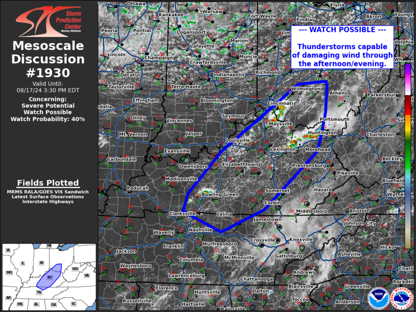
Areas affected...Southern Ohio...Central Kentucky...Northern Middle
Tennessee
Concerning...Severe potential...Watch possible
Valid 171731Z - 171930Z
Probability of Watch Issuance...40 percent
SUMMARY...Strong to severe storms capable of damaging wind to
increase in cover through the afternoon/evening.
DISCUSSION...An increase in cumulus development is noted in visible
satellite across portions of central Kentucky along and ahead of an
approaching cold front across IL/IN. A cluster of elevated
convection continues to move across areas north of Lexington, with
objective analysis still indicated some MLCIN may remain in place
across the region. Additional cells are also developing north of
Bowling Green. Daytime heating has led to temperatures in the upper
80s to 90s, with MLCAPE around 2500-3000 J/kg. As a mid-level speed
max and large scale forcing spreads across this region this
afternoon, further thunderstorm development is expected to continue
through the afternoon and evening, with potential for locally
gusty/damaging winds. Should storms intensify, a watch may be needed
to cover this threat later in the afternoon.
..Thornton/Hart.. 08/17/2024
...Please see www.spc.noaa.gov for graphic product...
ATTN...WFO...RLX...JKL...ILN...LMK...OHX...
LAT...LON 37098680 38078585 38908464 39628358 39688276 39618272
38988277 38518290 38088303 36738459 36208583 36688694
37098680
|
|
Top/All Mesoscale Discussions/Forecast Products/Home
|
|


 @NWSSPC