|
| Mesoscale Discussion 1922 |
|
< Previous MD Next MD >
|

|
   Mesoscale Discussion 1922
   NWS Storm Prediction Center Norman OK
   0320 PM CDT Fri Aug 16 2024

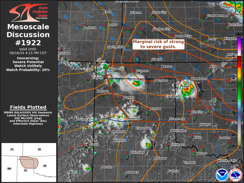
   Areas affected...Oklahoma and Texas Panhandles...western Oklahoma

   Concerning...Severe potential...Watch unlikely

   Valid 162020Z - 162115Z

   Probability of Watch Issuance...20 percent

   SUMMARY...Marginal risk of strong to severe wind will be possible
   through the afternoon.

   DISCUSSION...Radar and visible satellite trends continue to show
   thunderstorm and cumulus development across portions of the Oklahoma
   and Texas Panhandles over the last hour. This suggests that capping
   has eroded, with temperatures exceeding 100 F in many locations. Dew
   points are in the low to mid 60s, with dew point depressions around
   40 degrees. The environment is further characterized by MLCAPE
   around 1000-2000 J/kg, steep low to mid-level lapse rates, and weak
   deep layer shear. This will likely yield multi-cell clusters with
   potential for strong to severe winds. With the lack of deep layer
   shear for organization, a watch is unlikely to be needed.

   ..Thornton/Thompson.. 08/16/2024

   ...Please see www.spc.noaa.gov for graphic product...

   ATTN...WFO...OUN...AMA...

   LAT...LON   35499934 35739919 36149914 36489931 36639940 36750030
               36920137 36910169 36920217 36950244 36760264 36700265
               36300248 35750222 35200163 35189960 35499934
|
|
Top/All Mesoscale Discussions/Forecast Products/Home
|
|


