|
| Mesoscale Discussion 1897 |
|
< Previous MD Next MD >
|

|
   Mesoscale Discussion 1897
   NWS Storm Prediction Center Norman OK
   1000 PM CDT Tue Aug 13 2024

   Areas affected...South-central Nebraska and North-central Kansas

   Concerning...Severe potential...Watch possible

   Valid 140300Z - 140500Z

   Probability of Watch Issuance...60 percent

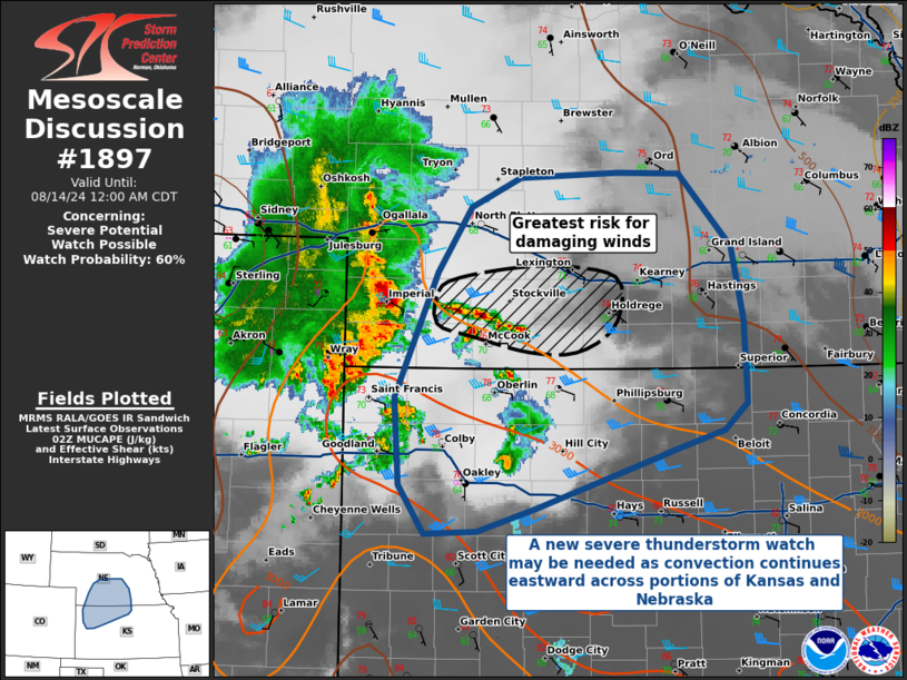
   SUMMARY...A new severe thunderstorm watch may be needed as a linear
   MCS continues to process eastward across southern Nebraska and
   northern Kansas.

   DISCUSSION...A linear MCS with a history of 60-70 MPH observed winds
   is continuing to progress across portions of northern Kansas and
   southern Nebraska, with a pronounced bow echo evident on radar in
   southern Nebraska. This bow echo will serve as the primary focus for
   the greatest short-term severe risk over the next few hours. Some
   uncertainty remains in the eastward longevity of this convective
   line, but SPC mesoanalysis suggests that continued warm air
   advection in the low levels has limited nocturnal boundary layer
   stabilization and subsequent development of MLCINH. The expectation
   is that the line will eventually weaken with eastward extent, but a
   new severe thunderstorm watch may be necessary if the line maintains
   its current strength.

   ..Halbert/Wendt/Edwards.. 08/14/2024

   ...Please see www.spc.noaa.gov for graphic product...

   ATTN...WFO...GID...LBF...DDC...GLD...

   LAT...LON   38730069 38710122 39090149 39770154 40740111 41250077
               41480026 41539928 41519865 40959811 40389800 39739797
               39519820 39369870 39329885 39139940 38910010 38730069
|
|
Top/All Mesoscale Discussions/Forecast Products/Home
|
|


