|
| Mesoscale Discussion 1882 |
|
< Previous MD Next MD >
|

|
   Mesoscale Discussion 1882
   NWS Storm Prediction Center Norman OK
   0353 PM CDT Sun Aug 11 2024

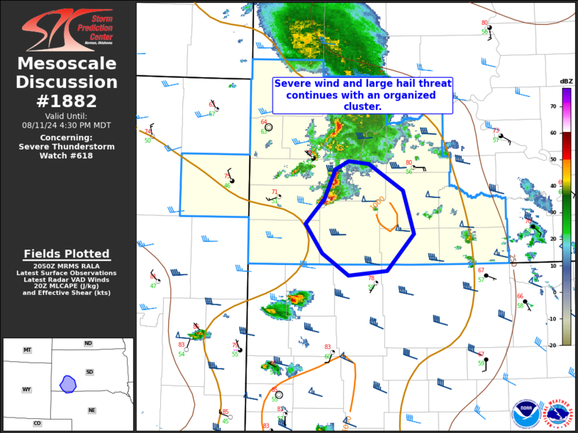
   Areas affected...Portions of southwestern SD into far northwestern
   NE

   Concerning...Severe Thunderstorm Watch 618...

   Valid 112053Z - 112230Z

   The severe weather threat for Severe Thunderstorm Watch 618
   continues.

   SUMMARY...Severe wind and large hail threat continues across Severe
   Thunderstorm Watch 618 -- especially with an organized
   southeastward-moving cluster.

   DISCUSSION...The latest radar data from KUDX depicts an organized
   cluster of thunderstorms (with an intense embedded supercell)
   tracking southeastward at around 30 kt. This activity will continue
   to be aided by 40 kt of 0-6 km shear (per UDX VWP data) oriented
   perpendicular to the associated gust front. Additionally,
   pre-convective low-level lapse rates continue to diurnally steepen
   amid middle/upper 50s dewpoints -- which should also support
   maintained storm intensity with southeastward extent. The primary
   concern is severe wind gusts (generally up to 70 mph) and large hail
   to around 2 inches in diameter. While less certain, a brief tornado
   cannot be ruled out given the embedded supercell mode and
   moist/backed east-southeasterly low-level flow to the east/southeast
   of these storms.

   ..Weinman.. 08/11/2024

   ...Please see www.spc.noaa.gov for graphic product...

   ATTN...WFO...LBF...UNR...

   LAT...LON   43710293 44020276 44110257 44080226 43800176 43330160
               42920199 42870257 43120296 43440321 43710293
|
|
Top/All Mesoscale Discussions/Forecast Products/Home
|
|


