|
| Mesoscale Discussion 1877 |
|
< Previous MD Next MD >
|

|
   Mesoscale Discussion 1877
   NWS Storm Prediction Center Norman OK
   0313 PM CDT Sat Aug 10 2024

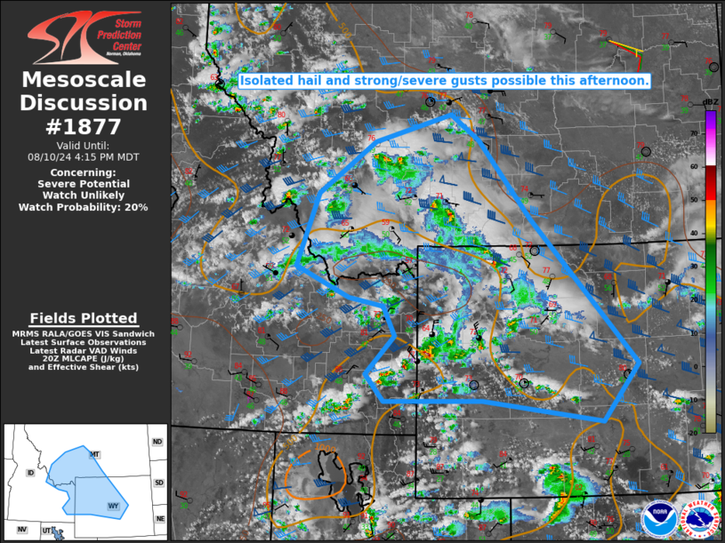
   Areas affected...Parts of eastern ID...southwest/south-central
   MT...western/central WY

   Concerning...Severe potential...Watch unlikely

   Valid 102013Z - 102215Z

   Probability of Watch Issuance...20 percent

   SUMMARY...Isolated hail and strong to severe gusts are possible this
   afternoon.

   DISCUSSION...Scattered thunderstorms have developed early this
   afternoon from eastern ID into southwest MT and western WY, in
   association with a shortwave trough moving across the interior
   Northwest. Low-level moisture remains rather limited, but steep
   midlevel lapse rates are supporting MLCAPE of near or above 500 J/kg
   where somewhat stronger diurnal heating has occurred. One supercell
   is ongoing near the ID/WY border, and effective shear of 30-40 kt
   will continue to support occasionally organized storms through the
   afternoon. Isolated hail and strong/severe gusts will be possible
   with the initially discrete storms. With time, one or more
   outflow-dominant clusters could evolve and spread
   east-southeastward, resulting in localized corridors of somewhat
   greater strong to severe gust potential.

   ..Dean/Goss.. 08/10/2024

   ...Please see www.spc.noaa.gov for graphic product...

   ATTN...WFO...CYS...BYZ...RIW...TFX...PIH...MSO...

   LAT...LON   42961217 43561154 44031180 44171256 44641374 45811326
               46631201 47081031 46670967 45410853 43100623 42180701
               42540962 42521176 42961217
|
|
Top/All Mesoscale Discussions/Forecast Products/Home
|
|


