|
| Mesoscale Discussion 1876 |
|
< Previous MD Next MD >
|

|
   Mesoscale Discussion 1876
   NWS Storm Prediction Center Norman OK
   0357 PM CDT Fri Aug 09 2024

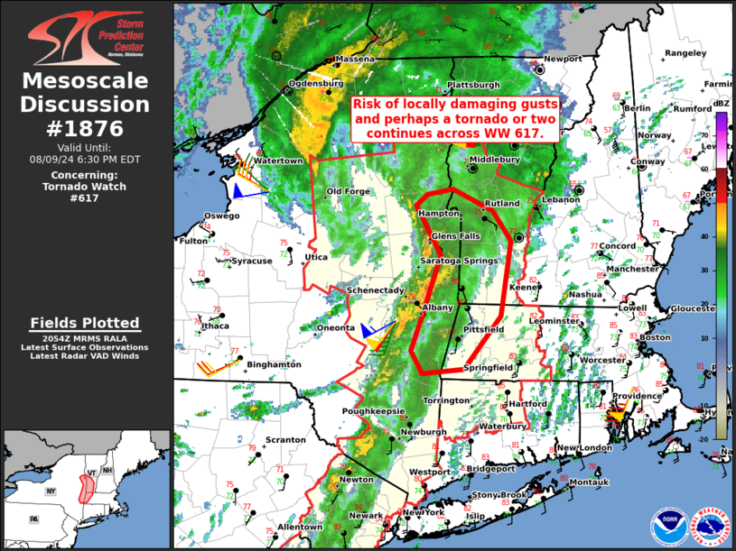
   Areas affected...Portions of eastern NY...southern VT...and western
   MA

   Concerning...Tornado Watch 617...

   Valid 092057Z - 092230Z

   The severe weather threat for Tornado Watch 617 continues.

   SUMMARY...Locally damaging gusts and perhaps a tornado or two remain
   possible across portions of Tornado Watch 617 in this evening.

   DISCUSSION...A band of low-topped thunderstorms is tracking eastward
   across portions of eastern NY this afternoon, though weak
   instability has generally limited updraft intensity thus far.
   However, very strong west-southwesterly deep-layer flow/shear could
   still support locally damaging gusts if any updrafts within the line
   are able to mature. And, with around 400 m2/s2 effective SRH ahead
   of the convection, a brief tornado or two cannot be ruled out.

   ..Weinman.. 08/09/2024

   ...Please see www.spc.noaa.gov for graphic product...

   ATTN...WFO...BOX...BTV...ALY...

   LAT...LON   42307386 42597375 43197349 43647381 43747366 43797335
               43607285 43327261 42627275 42147321 42107373 42307386
|
|
Top/All Mesoscale Discussions/Forecast Products/Home
|
|


