|
| Mesoscale Discussion 1870 |
|
< Previous MD Next MD >
|

|
   Mesoscale Discussion 1870
   NWS Storm Prediction Center Norman OK
   0738 PM CDT Thu Aug 08 2024

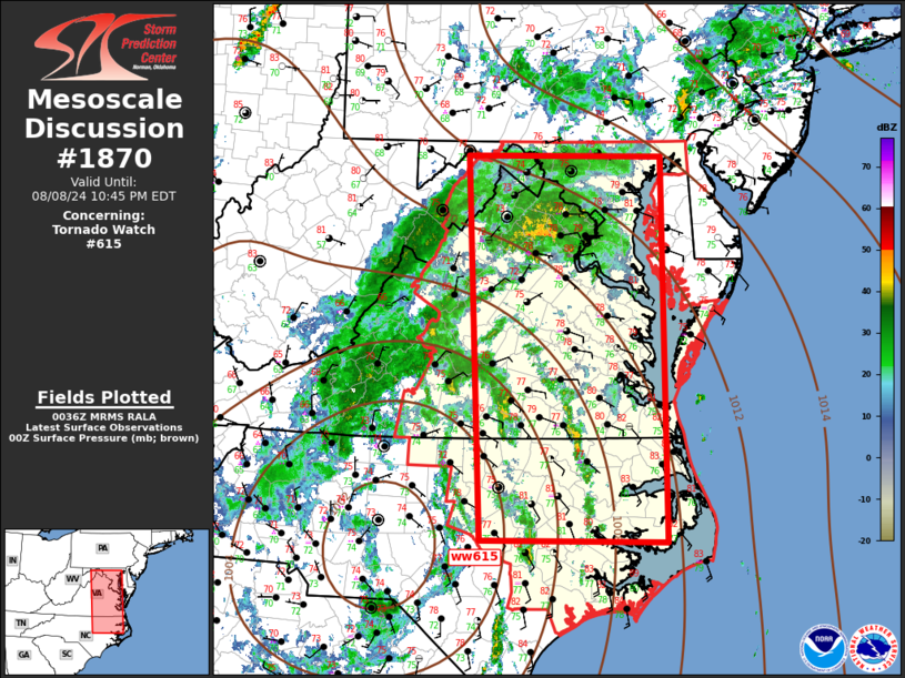
   Areas affected...Middle Atlantic

   Concerning...Tornado Watch 615...

   Valid 090038Z - 090245Z

   The severe weather threat for Tornado Watch 615 continues.

   SUMMARY...Tornado risk continues with supercells this evening.

   DISCUSSION...Remnants of Debby have moved well inland and the center
   of circulation is now located over western NC, east of CLT. LLJ is
   strengthening across the middle Atlantic with latest model guidance
   suggesting this will continue through sunrise as LLJ translates into
   northern VA/MD/southern PA. Latest VAD data supports this with 0-3km
   SRH now in excess of 300 m2/s2 at LWX. Numerous small supercells are
   embedded within a larger precip shield, supported by moist low-level
   warm advection. Radar data suggests several of the more robust
   circulations have possibly produced tornadoes at times. While strong
   shear persists across portions of the Carolinas, with time the
   primary focus for organized supercells will begin to shift north
   across VA into MD.

   ..Darrow.. 08/09/2024

   ...Please see www.spc.noaa.gov for graphic product...

   ATTN...WFO...PHI...AKQ...MHX...LWX...RAH...RNK...

   LAT...LON   35447858 39567876 39567614 35437609 35447858
|
|
Top/All Mesoscale Discussions/Forecast Products/Home
|
|


