|
| Mesoscale Discussion 1854 |
|
< Previous MD Next MD >
|

|
   Mesoscale Discussion 1854
   NWS Storm Prediction Center Norman OK
   1125 PM CDT Tue Aug 06 2024

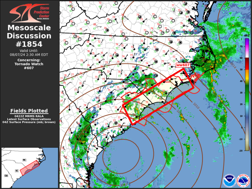
   Areas affected...Coastal Carolinas

   Concerning...Tornado Watch 607...

   Valid 070425Z - 070630Z

   The severe weather threat for Tornado Watch 607 continues.

   SUMMARY...Risk of tornadoes is gradually lowering across coastal
   portions of the Carolinas. New tornado watch is not currently
   expected.

   DISCUSSION...TS Debby remains located off the Carolina Coast south
   of CHS. Several broken convective bands persist within the eastern
   hemisphere of this cyclone with the most pronounced activity
   rotating inland from southeast SC into southern NC, within the main
   body of ww607. 00z soundings from CHS and MHX exhibit only modest
   shear with typical poor lapse rates and weak buoyancy. Earlier this
   evening several weak supercells were noted within the stronger
   bands, but updrafts appear to have weakened per radar and lightning
   data. Given the modest shear, and poor buoyancy, new Tornado Watch
   is not currently anticipated.

   ..Darrow.. 08/07/2024

   ...Please see www.spc.noaa.gov for graphic product...

   ATTN...WFO...MHX...RAH...ILM...CHS...

   LAT...LON   33777996 35257702 34477656 33007950 33777996
|
|
Top/All Mesoscale Discussions/Forecast Products/Home
|
|


