|
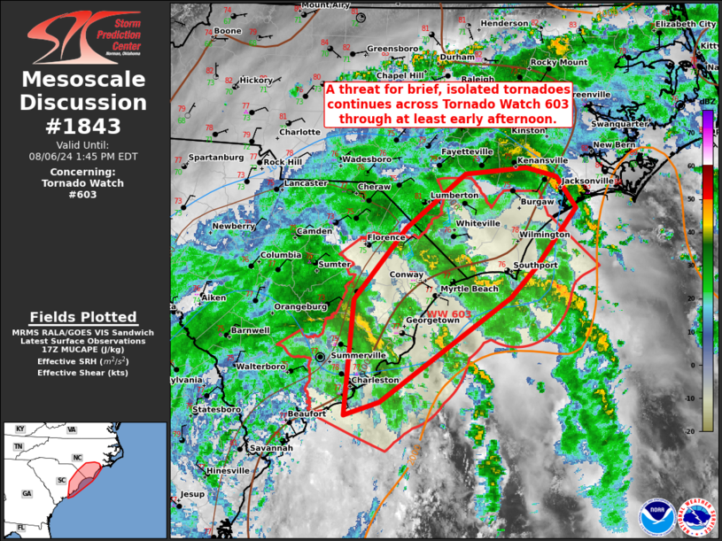
| Mesoscale Discussion 1843 |
|
< Previous MD Next MD >
|

|
   Mesoscale Discussion 1843
   NWS Storm Prediction Center Norman OK
   1215 PM CDT Tue Aug 06 2024

   Areas affected...portions of northeast South Carolina into southern
   North Carolina

   Concerning...Tornado Watch 603...

   Valid 061715Z - 061745Z

   CORRECTED FOR WORDING

   The severe weather threat for Tornado Watch 603 continues.

   SUMMARY...An isolated tornado threat continues across portions of
   the coastal Carolinas in association with Tropical Storm Debby. A
   few brief tornadoes may accompany the stronger storms through at
   least early afternoon.

   DISCUSSION...Multiple bands of stronger showers and thunderstorms
   are impinging on the counties in northern SC into southern NC that
   border the Atlantic in advance of the center of TS Debby, which
   continues to gradually drift north-northeastward this morning. Given
   poor tropospheric lapse rates and widespread, persistent cloud
   cover, overall buoyancy should remain modest (i.e. 500-1000 J/kg
   MLCAPE, supported mainly by mid to upper 70s F surface dewpoints).
   Around 200-300 m2/s2 of effective SRH may overspread the 80+ F
   surface temperatures along coastal NC later this afternoon, where a
   slight uptick in tornado potential may be realized. Otherwise, a
   persistent threat of a stray, brief tornado should persist while
   gradually shifting northward along the NC Outer Banks through the
   day.

   ..Squitieri.. 08/06/2024

   ...Please see www.spc.noaa.gov for graphic product...

   ATTN...WFO...MHX...RAH...ILM...CHS...

   LAT...LON   34857747 34557724 33967770 33667801 32627958 32498000
               33637988 34357926 34897855 34947783 34857747
|
|
Top/All Mesoscale Discussions/Forecast Products/Home
|
|


