|
| Mesoscale Discussion 1829 |
|
< Previous MD Next MD >
|

|
   Mesoscale Discussion 1829
   NWS Storm Prediction Center Norman OK
   0359 PM CDT Mon Aug 05 2024

   Areas affected...central and southern New York and northern
   Pennsylvania

   Concerning...Severe Thunderstorm Watch 597...598...

   Valid 052059Z - 052230Z

   The severe weather threat for Severe Thunderstorm Watch 597, 598
   continues.

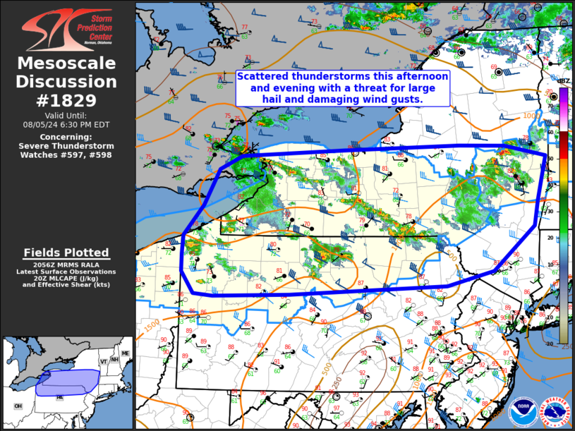
   SUMMARY...Scattered thunderstorms should continue this afternoon and
   evening with a threat for large hail and damaging wind gusts.

   DISCUSSION...Scattered thunderstorms have developed in the vicinity
   of a stationary front across New York and northern Pennsylvania this
   afternoon. These storms have had occasional supercell
   characteristics with mostly sporadic wind damage (42 knot gust at
   Wellsboro Airport, PA) and mostly sub-severe hail. The strongest
   storms will be diurnally driven with most of the threat waning near
   sunset which should coincide well with the 00Z expiration time.

   ..Bentley.. 08/05/2024

   ...Please see www.spc.noaa.gov for graphic product...

   ATTN...WFO...OKX...ALY...BGM...BUF...CTP...PBZ...CLE...

   LAT...LON   41128027 41448051 41718051 41978048 42438009 42957979
               43157935 43257738 43317503 43297412 43137331 42497350
               42127358 41477439 41267532 41147838 41107988 41128027
|
|
Top/All Mesoscale Discussions/Forecast Products/Home
|
|


