|
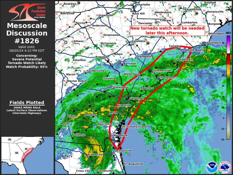
| Mesoscale Discussion 1826 |
|
< Previous MD Next MD >
|

|
   Mesoscale Discussion 1826
   NWS Storm Prediction Center Norman OK
   0149 PM CDT Mon Aug 05 2024

   Areas affected...coastal and near coastal counties of Georgia and
   South Carolina.

   Concerning...Severe potential...Tornado Watch likely

   Valid 051849Z - 052015Z

   Probability of Watch Issuance...95 percent

   SUMMARY...A new tornado watch will be needed later this afternoon in
   coastal areas across eastern Georgia and eastern South Carolina.

   DISCUSSION...Instability has mostly struggled to move inland within
   the northeastern quadrant of Tropical Storm Debby where persistent
   stratiform rain has been present all day. A push of higher moisture
   content and greater instability is advancing toward the
   Georgia/South Carolina coast. This may result in a greater threat
   for cellular convection and stronger updrafts late this afternoon
   and this evening. Any storms which can develop would pose a tornado
   threat given the favorable wind shear sampled by the JAX VWP. In
   addition, the low-level hodograph is starting to elongate at CLX,
   with this increasing low-level shear expected to advance up the
   coast this evening and into the overnight hours. With tornado watch
   596 expiring at 20Z, a new tornado watch will be issued for portions
   of coastal South Carolina and parts of Coastal Georgia.

   ..Bentley/Hart.. 08/05/2024

   ...Please see www.spc.noaa.gov for graphic product...

   ATTN...WFO...ILM...CHS...JAX...

   LAT...LON   31978066 31278111 30698135 30438153 30768182 31158185
               31458176 32618127 33228028 33787963 33887905 33847864
               33617866 33237899 32947920 32428005 31978066
|
|
Top/All Mesoscale Discussions/Forecast Products/Home
|
|


