|
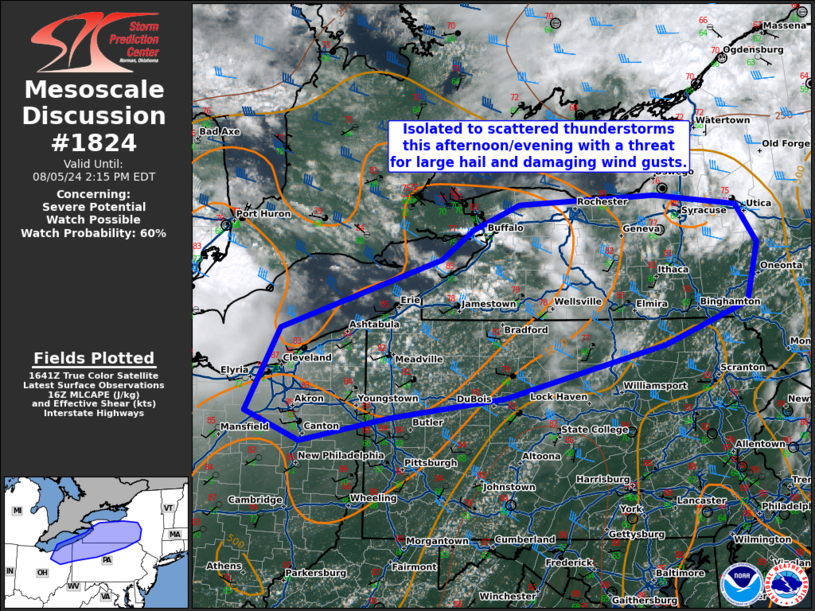
| Mesoscale Discussion 1824 |
|
< Previous MD Next MD >
|

|
   Mesoscale Discussion 1824
   NWS Storm Prediction Center Norman OK
   1148 AM CDT Mon Aug 05 2024

   Areas affected...northeast Ohio...northwest and north-central
   Pennsylvania...western and central New York.

   Concerning...Severe potential...Watch possible

   Valid 051648Z - 051815Z

   Probability of Watch Issuance...60 percent

   SUMMARY...Isolated to scattered thunderstorms are possible this
   afternoon/evening with a threat for large hail and damaging wind
   gusts.

   DISCUSSION...Destabilization is underway from northern Ohio into
   southern New York where temperatures have warmed into the mid 80s
   with dewpoints near 70F. Weak confluence in the vicinity if a
   stationary front across the region, in addition to some lake-breeze
   convergence, will be the primary focus for convective initiation as
   a weak mid-level shortwave trough approaches the region from the
   west. Moderate west-northwesterly shear (40 to 45 knots) will
   support supercells with the threat for large hail and damaging wind
   gusts.

   ..Bentley/Hart.. 08/05/2024

   ...Please see www.spc.noaa.gov for graphic product...

   ATTN...WFO...BGM...BUF...CTP...PBZ...CLE...

   LAT...LON   41018217 41888171 42617947 42937903 43187840 43257653
               43087584 42137597 41187859 40968019 40718141 41018217
|
|
Top/All Mesoscale Discussions/Forecast Products/Home
|
|


