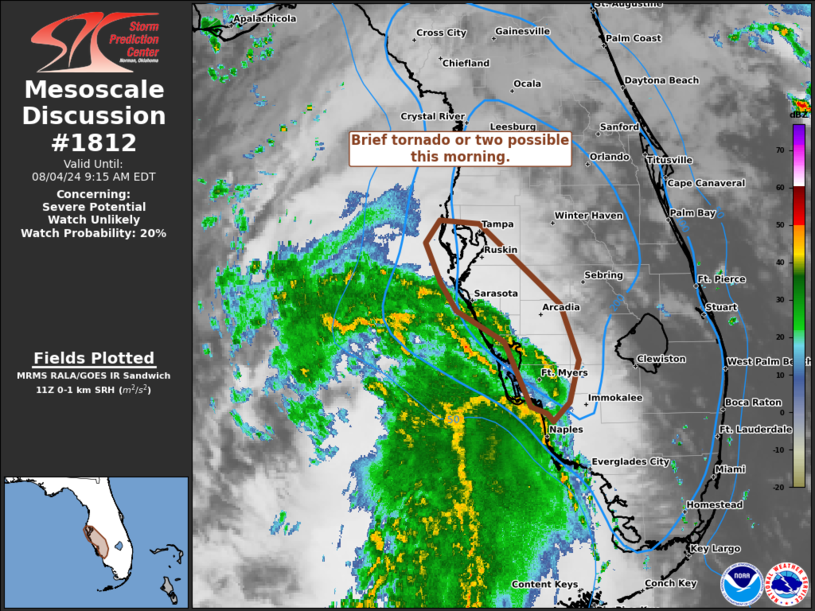
|
| Mesoscale Discussion 1812 |
|
< Previous MD Next MD >
|

|
   Mesoscale Discussion 1812
   NWS Storm Prediction Center Norman OK
   0647 AM CDT Sun Aug 04 2024

   Areas affected...Coastal west-central/southwest FL Peninsula

   Concerning...Severe potential...Watch unlikely

   Valid 041147Z - 041315Z

   Probability of Watch Issuance...20 percent

   SUMMARY...A brief tornado or two is possible into late morning with
   an outer band of showers gradually advancing north from the
   southwest to west-central Florida Gulf Coast, in association with TS
   Debby.

   DISCUSSION...A persistent arc of moderate-topped showers from
   western Collier to Sarasota counties has had transient but largely
   weak attempts at low-level rotation. This arc is within a corridor
   for enhanced low-level SRH, around 200-250 m2/s2, per time-series of
   TBW VWP data. Diminishing hodograph curvature exists to its south
   per BYX VWP data, where low-level and surface winds are nearly
   unidirectional from the south. The overall threat will likely remain
   spatially confined and limited in potential intensity beyond a weak,
   brief tornado or two. Greater potential for rotating cells across a
   broader area of the central peninsula may become evident towards
   midday.

   ..Grams/Edwards.. 08/04/2024

   ...Please see www.spc.noaa.gov for graphic product...

   ATTN...WFO...MFL...TBW...

   LAT...LON   28038284 28018246 27308166 26808148 26448156 26278172
               26348178 26408194 26978220 27248268 27498283 27848298
               28038284
|
|
Top/All Mesoscale Discussions/Forecast Products/Home
|
|


