|
| Mesoscale Discussion 1810 |
|
< Previous MD Next MD >
|

|
   Mesoscale Discussion 1810
   NWS Storm Prediction Center Norman OK
   0854 PM CDT Sat Aug 03 2024

   Areas affected...central/southern MN

   Concerning...Severe Thunderstorm Watch 593...

   Valid 040154Z - 040330Z

   The severe weather threat for Severe Thunderstorm Watch 593
   continues.

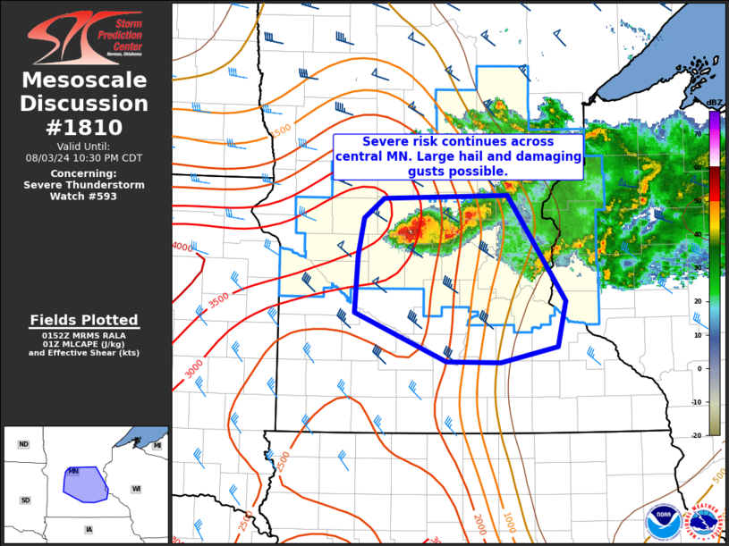
   SUMMARY...Isolated severe thunderstorms producing large hail and
   damaging gusts remain possible across central Minnesota this
   evening. Some risk could persist south of WW 593 and a local spatial
   extension is possible.

   DISCUSSION...A supercell on the western flank of the cluster of
   storms moving through central MN remains rather intense this
   evening, with MRMS MESH consistently indicating large hail around
   1.5-2.5 inches is possible. This aligns well with earlier reports,
   though some minor weakening may be occurring at this time.
   Nevertheless, this activity is developing southward within a
   moderately sheared environment along a strong instability gradient.
   This may allow for organized severe convection to persist with
   southward extent for a few more hours this evening. Current timing
   has this cluster reaching the edge of WW 593 by 03z. If current
   intensity is maintained, a local spatial extension into parts of
   southern MN may be necessary.

   ..Leitman.. 08/04/2024

   ...Please see www.spc.noaa.gov for graphic product...

   ATTN...WFO...MPX...

   LAT...LON   45769504 45789336 44779258 44339268 44179345 44189419
               44669542 45209539 45569531 45769504
|
|
Top/All Mesoscale Discussions/Forecast Products/Home
|
|


