|
| Mesoscale Discussion 1800 |
|
< Previous MD Next MD >
|

|
   Mesoscale Discussion 1800
   NWS Storm Prediction Center Norman OK
   0753 PM CDT Fri Aug 02 2024

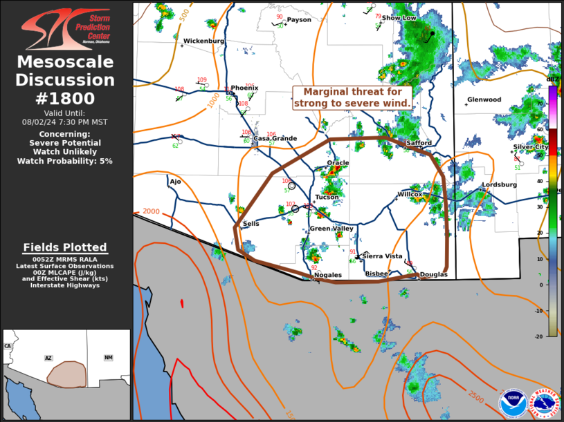
   Areas affected...southeastern Arizona

   Concerning...Severe potential...Watch unlikely

   Valid 030053Z - 030230Z

   Probability of Watch Issuance...5 percent

   SUMMARY...Marginal risk of strong to severe wind will continue
   through the evening.

   DISCUSSION...Thunderstorms ongoing across southeastern Arizona have
   shown strengthening in the last hour near and east of Tucson.
   Temperatures across much of the region are 100+ F with dew points in
   the low to mid 50s. Daytime heating has yielded MLCAPE around
   500-1500 J/kg. The 00z sounding from Tucson depicts steep low to
   mid-level lapse rates, with characteristic inverted V and very dry
   surface conditions. Though flow is weak, large 40-50 degree dew
   point depressions and steep lapse rates will support risk for strong
   to severe gusts through the evening.

   ..Thornton/Smith.. 08/03/2024

   ...Please see www.spc.noaa.gov for graphic product...

   ATTN...WFO...TWC...

   LAT...LON   31911196 32531148 32931071 32940996 32740936 32490919
               32180917 31830915 31480916 31390921 31350950 31400956
               31321006 31311063 31361091 31411113 31541169 31661192
               31911196
|
|
Top/All Mesoscale Discussions/Forecast Products/Home
|
|


