|
| Mesoscale Discussion 1796 |
|
< Previous MD Next MD >
|
|
Mesoscale Discussion 1796
NWS Storm Prediction Center Norman OK
0349 PM CDT Fri Aug 02 2024
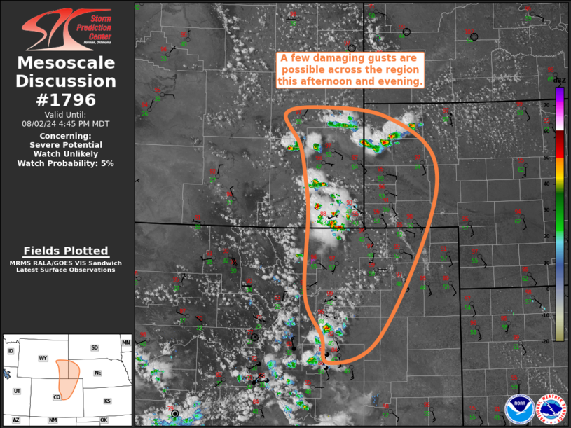
Areas affected...Southeast WY...NE Panhandle...Northeast CO
Concerning...Severe potential...Watch unlikely
Valid 022049Z - 022245Z
Probability of Watch Issuance...5 percent
SUMMARY...A few damaging gusts are possible across the region this
afternoon and evening.
DISCUSSION...Surface temperatures have warmed in the upper 90s/low
100s amid strong boundary-layer mixing across the central High
Plains. This strong mixing has dropped dewpoints in the upper
40s/low 50s, which is still sufficient for airmass destabilization,
with little to no convective inhibition remaining on recent
mesoanalysis. Given that this region is beneath the upper ridge, mid
to upper level flow is weak. Even so, modest vertical shear is still
possible across the region given the strong veering from surface
southeasterlies to modest mid-level northwesterlies. Recent
mesoanalysis estimates effective bulk shear around 30 kt. While this
is likely enough shear for some modest updraft organization, the
combination of modest buoyancy with this modest shear will likely
prevent an organization storm mode. However, given the high cloud
bases and steep low-level lapse rates, a few damaging gusts may
occur as updrafts collapse.
..Mosier/Hart.. 08/02/2024
...Please see www.spc.noaa.gov for graphic product...
ATTN...WFO...LBF...PUB...BOU...CYS...
LAT...LON 39180378 38820480 39250493 39910529 41190524 41820530
42340543 42820574 42930500 42800359 42150255 41020268
39180378
|
|
Top/All Mesoscale Discussions/Forecast Products/Home
|
|


 @NWSSPC