|
| Mesoscale Discussion 1780 |
|
< Previous MD Next MD >
|

|
   Mesoscale Discussion 1780
   NWS Storm Prediction Center Norman OK
   0917 PM CDT Wed Jul 31 2024

   Areas affected...Portions of northeastern Kansas and northwestern
   Missouri

   Concerning...Severe potential...Severe Thunderstorm Watch likely

   Valid 010217Z - 010345Z

   Probability of Watch Issuance...80 percent

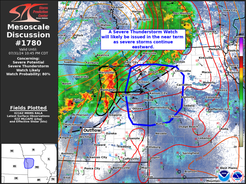
   SUMMARY...A Severe Thunderstorm Watch will likely be issued for
   portions of northeastern Kansas and northwestern Missouri in the
   near-term. Severe storms capable of producing damaging winds will
   continue eastward into the area.

   DISCUSSION...An MCS is tracking eastward across northeastern KS at
   around 40 kt. These storms and related outflow have recently
   produced 60-70 mph wind gusts, and VWP data from KTWX recently
   sampled a 53 kt rear-inflow jet. Despite these storms being slightly
   behind the leading edge of a large outflow boundary extending across
   the area, extreme surface-based buoyancy (see TOP 00Z sounding) and
   30 to 40 kt of deep-layer shear oblique to the line will favor
   continued organization and intensity with eastward extent into
   northwestern MO. The primary concern is 70-80 mph wind gusts.

   A watch will likely be issued in the near-term parts of the area.

   ..Weinman/Smith.. 08/01/2024

   ...Please see www.spc.noaa.gov for graphic product...

   ATTN...WFO...SGF...EAX...TOP...

   LAT...LON   38409536 39219552 39939531 40049501 40069432 39999348
               39709317 38709328 38259377 38159452 38199520 38409536
|
|
Top/All Mesoscale Discussions/Forecast Products/Home
|
|


