|
| Mesoscale Discussion 1772 |
|
< Previous MD Next MD >
|

|
   Mesoscale Discussion 1772
   NWS Storm Prediction Center Norman OK
   0512 PM CDT Wed Jul 31 2024

   Areas affected...Parts of southwestern IA...northwestern MO...and
   northeastern into central KS

   Concerning...Severe potential...Watch likely

   Valid 312212Z - 010015Z

   Probability of Watch Issuance...80 percent

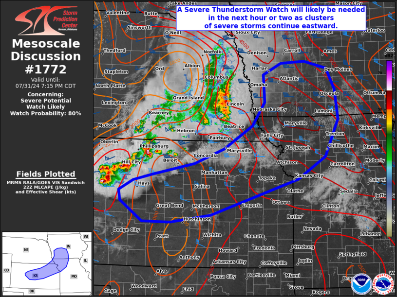
   SUMMARY...A Severe Thunderstorm Watch will likely be issued within
   the next hour or two, as clusters of severe storms continue
   eastward. Severe wind gusts and large hail will be the main
   concerns.

   DISCUSSION...Clusters of severe storms are ongoing across
   southeastern NE into northern KS as of 22Z -- ahead of an
   eastward-moving cold front. 40-50 kt of effective shear and strong
   to extreme surface-based instability are supporting a mix of
   organized multicells and supercell clusters, which have produced
   severe wind gusts upwards of 65-85 mph and large hail in the
   1.5-1.75 inch range (one isolated report of 4 inches in Phillips
   County, KS earlier).

   Over the next several hours, these storms will continue tracking
   eastward within a favorable environment for continued organized
   storms, including organized upscale-growing multicells and supercell
   clusters. Severe wind gusts (65-85 mph) and very large hail to
   around 2.5 inches will be the main concerns. A watch will likely be
   issued within an hour or two.

   ..Weinman/Smith.. 07/31/2024

   ...Please see www.spc.noaa.gov for graphic product...

   ATTN...WFO...DMX...EAX...OAX...TOP...ICT...GID...DDC...

   LAT...LON   39049944 39179888 39469759 39809670 40369582 40929544
               41569548 41839493 41889421 41709352 41219327 40499319
               39629360 39089444 38239708 38059831 38069915 38559982
               38799987 39049944
|
|
Top/All Mesoscale Discussions/Forecast Products/Home
|
|


