|
| Mesoscale Discussion 1724 |
|
< Previous MD Next MD >
|

|
   Mesoscale Discussion 1724
   NWS Storm Prediction Center Norman OK
   1239 AM CDT Mon Jul 29 2024

   Areas affected...southeast SD...northeast NE and western IA

   Concerning...Severe potential...Watch possible

   Valid 290539Z - 290745Z

   Probability of Watch Issuance...40 percent

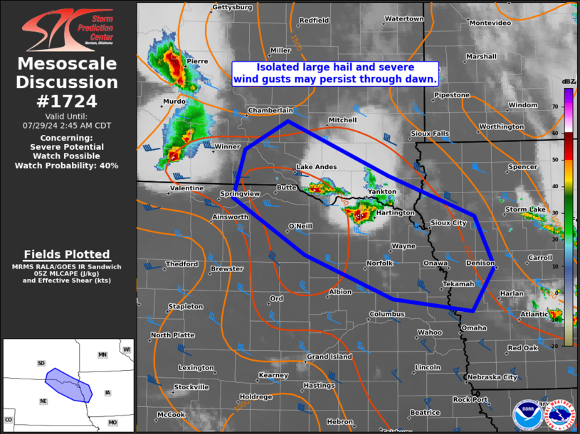
   SUMMARY...Isolated large hail and severe gusts may remain possible
   through the pre-dawn hours early this morning with a pair of
   slow-moving supercells over the Mid-Missouri Valley.

   DISCUSSION...In between a broader MCV over northeast IA and a
   smaller MCV in central SD, a pair of slow-moving supercells have
   developed along the southeast SD/northeast NE border area. This
   activity is within a zone of lower-level warm theta-e advection,
   with increasingly pronounced MLCIN in the warm-moist sector to its
   south-southwest. Most guidance suggests that the advection regime
   should gradually subside within this corridor over the next several
   hours. But given the upstream MCV over central SD moving about twice
   as fast as these storms, it is plausible that a merging may occur
   during the next few hours. One of the 00Z NSSL-MPAS runs, which
   appears to have a decent handle on both convective areas, supports
   this scenario. This could result in the initial primary threat of
   large hail, transitioning to more of a severe wind threat later this
   morning.

   ..Grams/Guyer.. 07/29/2024

   ...Please see www.spc.noaa.gov for graphic product...

   ATTN...WFO...DMX...FSD...OAX...LBF...

   LAT...LON   42189836 42849952 43409933 43749866 43109704 42629568
               42039537 41509573 41669697 42189836
|
|
Top/All Mesoscale Discussions/Forecast Products/Home
|
|


