|
| Mesoscale Discussion 1703 |
|
< Previous MD Next MD >
|
|
Mesoscale Discussion 1703
NWS Storm Prediction Center Norman OK
0402 PM CDT Wed Jul 24 2024
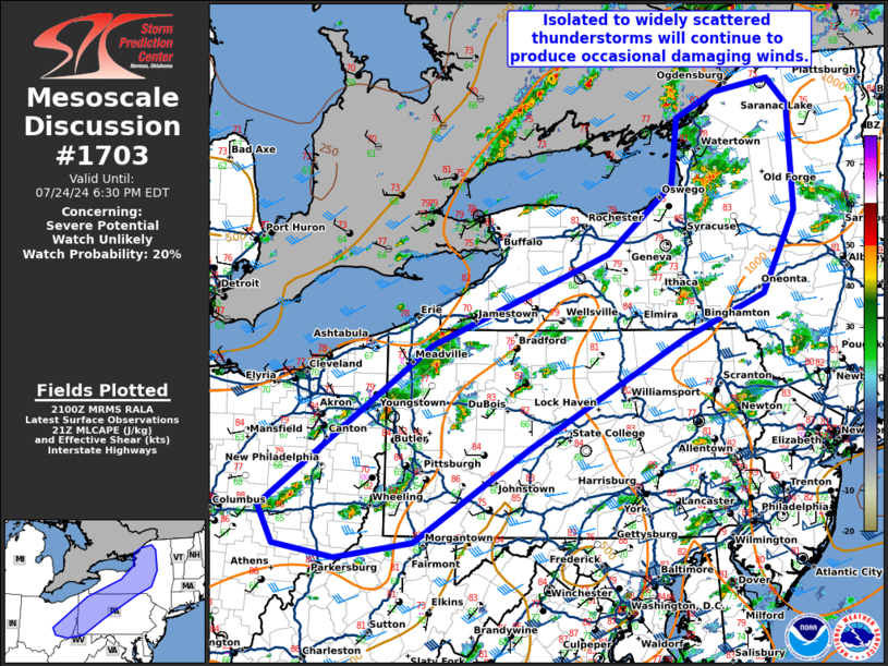
Areas affected...eastern Ohio...western and northern
Pennsylvania...and central New York
Concerning...Severe potential...Watch unlikely
Valid 242102Z - 242230Z
Probability of Watch Issuance...20 percent
SUMMARY...Isolated to widely scattered thunderstorms will continue
to produce occasional damaging winds this afternoon/evening.
DISCUSSION...Scattered thunderstorms have developed within a broad
region of moderate instability (1000 to 1500 J/kg MLCAPE). None of
these storms have been particularly strong, but 25-30 knots of
effective shear have permitted some organized cells to
develop/persist from eastern Ohio into New York. Expect this
continue for several more hours with a threat for damaging wind
gusts before the threat lessens this evening as the boundary layer
begins to cool.
Despite several strong to severe storms, a watch is not anticipated
due to the widely scattered nature of the threat.
..Bentley/Thompson.. 07/24/2024
...Please see www.spc.noaa.gov for graphic product...
ATTN...WFO...BTV...ALY...BGM...BUF...CTP...PBZ...RLX...CLE...
ILN...
LAT...LON 40028233 41817985 42827728 43587632 44307624 44587567
44727486 44437456 43277451 42377499 41897616 40687843
39648009 39468121 39608211 40028233
|
|
Top/All Mesoscale Discussions/Forecast Products/Home
|
|


 @NWSSPC